Willapa Hills
| Willapa Hills | |
|---|---|
|
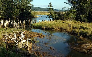
Willapa Bay with Willapa Hills in the background |
|
| Highest peak | Boistfort Peak ( 941 m ) |
| location | Washington (USA) |
| Coordinates | 46 ° 40 ′ N , 123 ° 30 ′ W |
| surface | 6,608 km² |
The Willapa Hills are about 100 km long mountain range in the southwest of the US state Washington . With a maximum height of 941 meters, they are the lowest part of the series of mountain ranges that stretch along the Pacific coast of North America.
geography
The Willapa Hills form a continuous range of mountains from the lower reaches of the Chehalis River to the Columbia River and are thus between the Olympic Mountains in the north and the Oregon Coast Range in the south. The highest elevation of the approximately 6600 km² mountain range is the 941 m high Boistfort Peak . The Willapa Hills also include the Doty Hills in Lewis County with the 737 m high Walville Peak and the Black Hills west of Olympia in Thurston County , only up to 187 m high . The Willapa Hills open up in broad valleys to the western Pacific, the eastern border to the cascade chain is not exactly defined. In front of the flat coast are headlands like the Long Beach Peninsula , which form large estuaries with Grays Harbor and Willapa Bay . The Willapa Hills, with high rainfall, are the headwaters of numerous streams and rivers such as the Chehalis River and the Willapa River .
geology
The mountain range consists of tertiary igneous rock and sedimentary rock. Unlike the Olympic Mountains, which are more than twice as high, the rocks of the Willapa Hils were not intensely deformed by metamorphosis . Geologists suspect that the subduction zone of the Juan de Fuca Plate is much deeper under the Willapa Hills than under the Olympic Mountains. Due to erosion, the Willapa Hills have a rounded and heavily weathered profile. Geologists have proven that around 1670 the coastline in the area of the Willapa Hills subsided over a length of 90 kilometers after an earthquake with a magnitude of 8.0 on the Richter scale . The forested areas were flooded by salt water, so that the trees died quickly.
In 1957 an oil well was drilled on the coast at Ocean Shores , which was the richest oil discovery in Washington.
climate
The continuous mountain range receives the full force of the winds that pull inland from the Pacific, i.e. heavy rainfall and violent storms in winter. In lower altitudes, wind speeds of 140 to 160 km / h can be reached in some years. A measuring station exposed at an altitude of 600 m and close to the ocean shows that wind speeds of more than 160 km / h are reached in almost every winter at this altitude.
nature
The Willapa Hills are used intensively for forestry, the original trees were largely cut down. In Rainbow Falls State Park , as well as in 225 hectares of Ellsworth Creek Natural Resources Conservation Area in Pacific County , there is a forest of giant trees of life , West American hemlock and Sitka spruce . The 90 kilometer long Willapa Hills Trail runs as a hiking, biking and riding trail on a former railway line of the Northern Pacific Railway from Chehalis to South Bend .
Web links
- Geology of Washington - Willapa Hills
- Willapa Hills in the United States Geological Survey's Geographic Names Information System
Individual evidence
- ↑ Peakbagger.com: Willapa Hills. Retrieved July 17, 2011 .
- ^ Climate of Washington. Retrieved July 4, 2011 .
- ^ Ellsworth Creek, Washington. (PDF; 23 kB) Retrieved July 14, 2011 .
- ↑ Willapa Hills Trail. Retrieved July 14, 2011 .
