Cyanika: Difference between revisions
→External links: new data |
Rescuing 2 sources and tagging 0 as dead.) #IABot (v2.0.9.2 |
||
| (4 intermediate revisions by one other user not shown) | |||
| Line 46: | Line 46: | ||
}} <!-- Infobox ends !--> |
}} <!-- Infobox ends !--> |
||
'''Cyanika''' is a populated settlement in [[Rwanda]]. It sits adjacent to [[Kyanika]], across the international border with neighboring Uganda.<ref name="1R">{{cite web|date=2019 | |
'''Cyanika''' is a populated settlement in [[Rwanda]]. It sits adjacent to [[Kyanika]], across the international border with neighboring Uganda.<ref name="1R">{{cite web |date=2019 |url=https://www.volcanoesnationalparkrwanda.com/rwanda/the-cyanika-border-is-a-very-important-key-for-tourism-uganda-rwanda.html |title=The Cyanika border is a very important key for tourism in Uganda & Rwanda |publisher=Volcanoes National Park (Not affiliated with Rwanda Development Board) |author=Volcanoes National Park (Not affiliated with Rwanda Development Board) |access-date=11 March 2019 |archive-date=10 December 2019 |archive-url=https://web.archive.org/web/20191210041236/https://www.volcanoesnationalparkrwanda.com/rwanda/the-cyanika-border-is-a-very-important-key-for-tourism-uganda-rwanda.html |url-status=dead }}</ref> Cyanika, also refers to ''Cyanika Sector'', one of the 17 administrative divisions of Burera District.<ref name="2R">{{cite web |date=2015 |url=http://rwandavillagemakeover.com/cyanika/ |access-date=11 March 2019 |publisher=Rwandavillagemakeover.com |author=Rwanda Village Makeover |title=Village Makeover: Cyanika |archive-date=8 March 2016 |archive-url=https://web.archive.org/web/20160308130542/http://rwandavillagemakeover.com/cyanika/ |url-status=dead }}</ref> |
||
==Location== |
==Location== |
||
| Line 53: | Line 53: | ||
==Overview== |
==Overview== |
||
Cyanika/Kyanika is one of the three major road crossings between Rwanda to the south and [[Uganda]] to the north. The other to are [[Gatuna]]/[[Katuna]] and [[Kagitumba]]/[[Mirama Hills]].<ref name="XXR">{{cite web|title=Ugandan goods denied entry into Rwanda |url=https://www.monitor.co.ug/News/National/Ugandan-goods-denied-entry-Rwanda-Mirama-hills-Ntungamo/688334-5017268-tvwlpt/index.html |newspaper=[[Daily Monitor]] |date=10 March 2019 | |
Cyanika/Kyanika is one of the three major road crossings between Rwanda to the south and [[Uganda]] to the north. The other to are [[Gatuna]]/[[Katuna]] and [[Kagitumba]]/[[Mirama Hills]].<ref name="XXR">{{cite web|title=Ugandan goods denied entry into Rwanda |url=https://www.monitor.co.ug/News/National/Ugandan-goods-denied-entry-Rwanda-Mirama-hills-Ntungamo/688334-5017268-tvwlpt/index.html |newspaper=[[Daily Monitor]] |date=10 March 2019 |access-date=11 March 2019 |first=Robert |last=Muhereza | location=Kampala}}</ref> |
||
In February 2019, Rwanda closed its borders to Ugandans and Ugandan goods, including at the Chanika/Kyanika border crossing. As a result, the annual trade worth approximately US$180 million to Uganda and about US$10 million to Rwanda came to a halt.<ref>{{cite news|url=https://www.bbc.com/news/world-africa-47495476 | title=How the Rwanda-Uganda border crossing came to a halt | publisher=[[BBC News|BBC Africa News]] |date=9 March 2019 | access-date=7 February 2020 |author=Catherine Byaruhanga | location=London}}</ref> As of February 2020, attempts by the presidents of Angola, [[João Lourenço]] and of the Democratic Republic of the Congo, [[Félix Tshisekedi]], have not yet resolved the impasse.<ref>{{cite web|title=Museveni, Kagame resolve to release prisoners |newspaper=[[Daily Monitor]] | url=https://www.monitor.co.ug/News/National/Museveni-Kagame-prisoners-Tshisekedi-Katuna/688334-5441468-dpgtsy/index.html | date=2 February 2020 |access-date=8 February 2020 | |
|||
author=Daily Monitor |location=Kampala}}</ref> |
|||
==Points of interest== |
==Points of interest== |
||
Latest revision as of 15:27, 3 October 2022
Cyanika | |
|---|---|
| Coordinates: 01°20′40″S 29°44′32″E / 1.34444°S 29.74222°E | |
| Country | |
| Province | Northern Province |
| District | Burera District |
| Elevation | 1,957 m (6,421 ft) |
| Time zone | UTC+2 (CAT) |
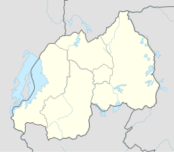
Cyanika is a populated settlement in Rwanda. It sits adjacent to Kyanika, across the international border with neighboring Uganda.[1] Cyanika, also refers to Cyanika Sector, one of the 17 administrative divisions of Burera District.[2]
Location[edit]
Cyanika is located in Cyanika Sector, Burera District, Northern Province, approximately 121 kilometres (75 mi), by road, north-west of Kigali, the capital and largest city of Rwanda.[3] The geographical coordinates of Cyanika, Burera District, Rwanda are: 1°20'40.0"S, 29°44'32.0"E (Latitude:-1.344444; Longitude:29.742222).[4] Cyanika sits at an average elevation of 1,957 metres (6,421 ft), above sea level.[5]
Overview[edit]
Cyanika/Kyanika is one of the three major road crossings between Rwanda to the south and Uganda to the north. The other to are Gatuna/Katuna and Kagitumba/Mirama Hills.[6]
In February 2019, Rwanda closed its borders to Ugandans and Ugandan goods, including at the Chanika/Kyanika border crossing. As a result, the annual trade worth approximately US$180 million to Uganda and about US$10 million to Rwanda came to a halt.[7] As of February 2020, attempts by the presidents of Angola, João Lourenço and of the Democratic Republic of the Congo, Félix Tshisekedi, have not yet resolved the impasse.[8]
Points of interest[edit]
The border crossing is in close proximity to Volcanoes National Park in Rwanda, Mgahinga Gorilla National Park in Uganda, and Virunga National Park, in the Democratic Republic of the Congo.[1]
References[edit]
- ^ a b Volcanoes National Park (Not affiliated with Rwanda Development Board) (2019). "The Cyanika border is a very important key for tourism in Uganda & Rwanda". Volcanoes National Park (Not affiliated with Rwanda Development Board). Archived from the original on 10 December 2019. Retrieved 11 March 2019.
- ^ Rwanda Village Makeover (2015). "Village Makeover: Cyanika". Rwandavillagemakeover.com. Archived from the original on 8 March 2016. Retrieved 11 March 2019.
- ^ Globefeed.com (11 March 2019). "Distance between Kigali, Rwanda and Cyanika, Burera, Rwanda". Globefeed.com. Retrieved 11 March 2019.
- ^ Google (11 March 2019). "Location of Cyanika, Burera District, Rwanda" (Map). Google Maps. Google. Retrieved 11 March 2019.
- ^ Mapcarta (2019). "Elevation of Cyanika, Burera, Rwanda". Mapcarta.com Map. Retrieved 11 March 2019.
- ^ Muhereza, Robert (10 March 2019). "Ugandan goods denied entry into Rwanda". Daily Monitor. Kampala. Retrieved 11 March 2019.
- ^ Catherine Byaruhanga (9 March 2019). "How the Rwanda-Uganda border crossing came to a halt". London: BBC Africa News. Retrieved 7 February 2020.
- ^ Daily Monitor (2 February 2020). "Museveni, Kagame resolve to release prisoners". Daily Monitor. Kampala. Retrieved 8 February 2020.

