
Eembrugge: Difference between revisions
...in the Netherlands |
KittenKlub (talk | contribs) expand |
||
| Line 1: | Line 1: | ||
{{Unreferenced stub|auto=yes|date=December 2009}} |
|||
{{Expand Dutch|date=June 2019|Eembrugge}} |
|||
{{Infobox settlement |
{{Infobox settlement |
||
|name = Eembrugge |
| name = Eembrugge |
||
| settlement_type = Hamlet |
|||
| ⚫ | |||
| official_name = <!-- if different from name --> |
|||
| ⚫ | |||
| native_name = <!-- if different from name --> |
|||
| ⚫ | |||
| native_name_lang = nl |
|||
| ⚫ | |||
| image_skyline = File:Brêge Iembrêge2.JPG |
|||
|subdivision_type2 = Municipality |
|||
| image_alt = |
|||
| ⚫ | |||
| |
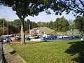
| image_caption = Eembrugge (2009) |
||
| |
| image_flag = |
||
| image_shield = |
|||
| ⚫ | |||
| |
| nickname = |
||
| |
| motto = |
||
| |
| image_map = |
||
| map_caption = |
|||
| ⚫ | |||
| image_map1 = |
|||
| ⚫ | |||
| |
| map_caption1 = |
||
| pushpin_map = Netherlands Utrecht#Netherlands |
|||
| pushpin_label_position = |
|||
| pushpin_map_caption = Location in the Netherlands |
|||
| ⚫ | |||
| ⚫ | |||
| ⚫ | |||
| ⚫ | |||
| subdivision_type2 = [[List of municipalities of the Netherlands|Municipality]] |
|||
| ⚫ | |||
| leader_title = |
|||
| leader_name = |
|||
| leader_party = |
|||
| elevation_footnotes = |
|||
| elevation_m = |
|||
| elevation_min_m = |
|||
| elevation_max_m = |
|||
| area_footnotes = <ref name="stat"/> |
|||
| area_total_km2 = 0.29 |
|||
| established_title = |
|||
| established_date = |
|||
| population_footnotes = <ref name="stat">{{cite web |url=https://www.cbs.nl/-/media/_excel/2021/48/kwb-2021.xls |title=Kerncijfers wijken en buurten 2021 |website=Central Bureau of Statistics |access-date=28 March 2022|quote=Statistics are for the Baarn part}}</ref> |
|||
| population_total = 35 |
|||
| ⚫ | |||
| population_demonym = |
|||
| population_note = |
|||
| population_density_km2 = auto |
|||
| timezone = [[Central European Time|CET]] |
|||
| utc_offset = +1 |
|||
| timezone_DST = [[Central European Summer Time|CEST]] |
|||
| utc_offset_DST = +2 |
|||
| postal_code_type = [[List of postal codes in the Netherlands|Postal code]] |
|||
| postal_code = 3755<ref name="stat"/> |
|||
| ⚫ | |||
| area_code = 035 |
|||
| website = |
|||
| footnotes = |
|||
| ⚫ | |||
}} |
}} |
||
[[File:Brêge Iembrêge2.JPG|thumb|Eembrugge, 2009]] |
|||
'''Eembrugge''' |
'''Eembrugge''' is a hamlet and former city on the river [[Eem]], east of [[Baarn]], in the [[Netherlands]]. It received [[City rights in the Netherlands|city rights]] between 1336 en 1340, but was destroyed in 1527. Eembrugge is partially in the municipality of [[Eemnes]], partially in [[Baarn]]. |
||
== History == |
|||
| ⚫ | |||
It was first mentioned in 1254 as "in orientale parte ecclesie de Ema", and means bridge over the [[Eem]] which was built in the 12th century. Eembrugge received city rights between 1336 and 1340 by [[Jan III van Diest]], the [[Prince-Bishopric of Utrecht]]. In 1527, Eembrugge was destroyed by the Duke of [[Gelre]].<ref>{{cite web|url=https://etymologiebank.nl/trefwoord/eembrugge |title=Eembrugge - (geografische naam) |website=Etymologiebank |access-date=28 March 2022 |language=nl}}</ref> Later, it became a little hamlet, and was overshadowed by neighbouring [[Eemnes]]. The church collapsed in the late-16th century after a flood, and was demolished in 1702. In 1840, it was home to 129 people.<ref>{{cite web|url=https://www.plaatsengids.nl/eembrugge |title=Eembrugge |website=Plaatsengids |access-date=28 March 2022 |language=nl}}</ref> |
|||
== Gallery == |
|||
<gallery> |
|||
File:HUA-201227-Gezicht op de zij en voorgevel van een eenbeukig omgracht huis met een brug naar de voorburcht.jpg|Castle Wakestyn (1700-1740) |
|||
File:Eembrugge Ocrieteiland haventje 3.JPG|Harbour |
|||
</gallery> |
|||
== References == |
|||
{{RefList}} |
|||
[[Category:Baarn]] |
[[Category:Baarn]] |
||
[[Category:Eemnes]] |
|||
[[Category:Populated places in Utrecht (province)]] |
[[Category:Populated places in Utrecht (province)]] |
||
| ⚫ | |||
Latest revision as of 21:39, 28 March 2022
Eembrugge | |
|---|---|
Hamlet | |
 Eembrugge (2009) | |
 Eembrugge Location in the Netherlands  Eembrugge Eembrugge (Netherlands) | |
| Coordinates: 52°13′N 5°18′E / 52.217°N 5.300°E | |
| Country | Netherlands |
| Province | Utrecht |
| Municipality | Baarn Eemnes |
| Area | |
| • Total | 0.29 km2 (0.11 sq mi) |
| Population (2021)[1] | |
| • Total | 35 |
| • Density | 120/km2 (310/sq mi) |
| Time zone | UTC+1 (CET) |
| • Summer (DST) | UTC+2 (CEST) |
| Postal code | 3755[1] |
| Dialing code | 035 |
Eembrugge is a hamlet and former city on the river Eem, east of Baarn, in the Netherlands. It received city rights between 1336 en 1340, but was destroyed in 1527. Eembrugge is partially in the municipality of Eemnes, partially in Baarn.
History[edit]
It was first mentioned in 1254 as "in orientale parte ecclesie de Ema", and means bridge over the Eem which was built in the 12th century. Eembrugge received city rights between 1336 and 1340 by Jan III van Diest, the Prince-Bishopric of Utrecht. In 1527, Eembrugge was destroyed by the Duke of Gelre.[2] Later, it became a little hamlet, and was overshadowed by neighbouring Eemnes. The church collapsed in the late-16th century after a flood, and was demolished in 1702. In 1840, it was home to 129 people.[3]
Gallery[edit]
-
 Castle Wakestyn (1700-1740)
 -
 Harbour


References[edit]
- ^ a b c "Kerncijfers wijken en buurten 2021". Central Bureau of Statistics. Retrieved 28 March 2022.
Statistics are for the Baarn part
- ^ "Eembrugge - (geografische naam)". Etymologiebank (in Dutch). Retrieved 28 March 2022.
- ^ "Eembrugge". Plaatsengids (in Dutch). Retrieved 28 March 2022.
This Utrecht location article is a stub. You can help Wikipedia by expanding it. |