Eemnes
 flag |
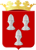
 coat of arms |
| province |
|
| mayor | Roland van Benthem ( VVD ) |
| Seat of the municipality | Eemnes |
|
Area - land - water |
33.67 km 2 31.13 km 2 2.54 km 2 |
| CBS code | 0317 |
| Residents | 9,144 (Jan 31, 2019) |
| Population density | 272 inhabitants / km 2 |
| Coordinates | 52 ° 15 ′ N , 5 ° 15 ′ E |
| Important traffic route |
|
| prefix | 035 |
| Postcodes | 3755 |
| Website | Homepage of Eemnes |
Eemnes ( ) is a municipality in the Dutch province of Utrecht . There are no further settlement areas within the municipal boundaries.
Location and economy
Eemnes is located immediately east of Laren in the province of North Holland (only separated from it by the A27 motorway), and five kilometers north of Soest (junction with the A1 motorway Amsterdam - Amersfoort ). It lies in the polders of the River Eem .
The main sources of income are livestock farming and tourism (marina on the Eem). But many residents are commuters who work in Hilversum , Amsterdam or elsewhere.
history
The elongated north-south village of Eemnes originally consists of two parts: Eemnes-Binnen and Eemnes-Buiten, north of it . Both have a historic Reformed Church. Both districts previously acquired town charter: Eemnes-Buiten as early as 1345, -Binnen finally in 1439. In Eemnes-Buiten there are older houses that belonged to the former village center. There is also the small former town hall, which is now used as a restaurant.
Web links
- Website of the municipality (Dutch)
- De Eem in the picture (Dutch)

Individual evidence
- ↑ Bevolkingsontwikkeling; regio per maand . In: StatLine . Centraal Bureau voor de Statistiek (Dutch)
