Woudenberg
 flag |
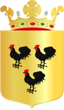
 coat of arms |
| province |
|
| mayor | Titia Cnossen ( CU ) |
| Seat of the municipality | Woudenberg |
|
Area - land - water |
36.72 km 2 36.47 km 2 0.25 km 2 |
| CBS code | 0351 |
| Residents | 13,205 (Jan 31, 2019) |
| Population density | 360 inhabitants / km 2 |
| Coordinates | 52 ° 5 ' N , 5 ° 25' E |
| Important traffic route |
|
| prefix | 033, 0343 |
| Postcodes | 3711, 3931 |
| Website | Homepage of Woudenberg |
Woudenberg ( ) is a village and a municipality in the Dutch province of Utrecht . There are no other villages within the municipal boundaries, but part of the Moorst peasantry.
Location and economy
Woudenberg is located in the east of the province, north of Maarsbergen (municipality of Utrechtse Heuvelrug) , south of Leusden and Amersfoort , east of Zeist and west of Scherpenzeel (province of Gelderland ). The road N224 Zeist - Scherpenzeel - Barneveld leads partly south around Woudenberg and crosses an industrial area belonging to the village in the east. As an alternative to the Barneveld - Utrecht route, this road is heavily used, as the highways near Amersfoort often have a very high volume of traffic.
From 1886 to 1944 the village had a train station on the Amersfoort - Rhenen - Kesteren line, which no longer exists . There were plans in 2007 to reactivate this railway line and reopen Woudenberg station, but these plans have not yet been implemented.
Woudenberg has quite a lot of small businesses and agriculture as well as several transport companies. The community is also well developed for tourism. Many residents commute to work in the surrounding cities.
history
Woudenberg, namely the place in the municipality Hengistscoto (Henschoten) was first mentioned in 777 when Charlemagne donated the area to the Martini church in the city of Utrecht. At the intersection of the paths from Austerlitz to Woudenberg and from Doorn to Amersfoort , a hostel was built next to a church in the 13th century. The intersection was also known as Quatre-Bras . There was a wooded hill nearby. That is why the newly emerging village, which was only 4 km from Quatre-Bras, was called Woudenberg (woud en berg = forest and mountain).
Around 1350 a castle stood here at the height of today's street 't Schilt. This was also the name of the castle.
Around 1410 a castle was built near the church between today's Burgwal (Burgwall) and the Middenstraat. There are no remains of this castle (De Burgwal).
The village grew slowly so that the population did not reach the 500-inhabitant limit until around 1900. Most of the residents were farmers. The street name Tabaksland is a reminder that tobacco was also grown in the municipality.
The village retained its rural character until the 1960s. Only then did it begin to grow to its present size , especially after the authorities classified the place as a major (growth core ).
Distribution of seats in the municipal council
Attractions
- The pyramid of Austerlitz (direction Maarsbergen) is located in the municipality of Woudenberg.
- The forests of the Utrechtse Heuvelrug extend south of the village with many hiking opportunities and the local recreation area and bathing beach Henschotermeer.
- In the center of the town there is an old, remarkable (Protestant) village church with an organ (almost only accessible for Sunday services)
Web links
- Website of the municipality (Dutch)
- Website of the tourist office of the Heuvelrug region (Dutch, German, English)
Individual evidence
- ↑ Bevolkingsontwikkeling; regio per maand . In: StatLine . Centraal Bureau voor de Statistiek (Dutch)


