Marcory: Difference between revisions
Content deleted Content added
Tentinator (talk | contribs) Clean up |
No edit summary Tags: Mobile edit Mobile web edit |
||
| (22 intermediate revisions by 10 users not shown) | |||
| Line 1: | Line 1: | ||
{{Infobox settlement |
{{Infobox settlement |
||
|name Marcory |
|name = Marcory |
||
|other_name = |
|other_name = |
||
|native_name = <!-- for cities whose native name is not in English --> |
|native_name = <!-- for cities whose native name is not in English --> |
||
|nickname = |
|nickname = |
||
|settlement_type = |
|settlement_type =Suburb and urban [[Communes of Ivory Coast|commune]] |
||
|motto = |
|motto = |
||
<!-- images and maps -----------> |
<!-- images and maps -----------> |
||
|image_skyline = |
|image_skyline = |
||
|imagesize = |
|imagesize = |
||
|image_caption = |
|image_caption =Photomontage of the Marcory commune of Abidjan |
||
|image_flag = |
|image_flag = |
||
|flag_size = |
|flag_size = |
||
| Line 16: | Line 16: | ||
|image_shield = |
|image_shield = |
||
|shield_size = |
|shield_size = |
||
|image_map = |
|image_map = Abidjan Communes.svg |
||
|mapsize = |
|mapsize = |
||
|map_caption = |
|map_caption = Location in Abidjan |
||
|pushpin_map = <!-- the name of a location map as per http://en.wikipedia.org/wiki/Template:Location_map --> |
|pushpin_map =Ivory Coast <!-- the name of a location map as per http://en.wikipedia.org/wiki/Template:Location_map --> |
||
|pushpin_label_position =bottom |
|pushpin_label_position =bottom |
||
|pushpin_mapsize = |
|pushpin_mapsize = |
||
|pushpin_map_caption =Location in |
|pushpin_map_caption =Location in Ivory Coast |
||
<!-- Location ------------------> |
<!-- Location ------------------> |
||
|subdivision_type = Country |
|subdivision_type = Country |
||
|subdivision_name = {{flag| |
|subdivision_name = {{flag|Ivory Coast}} |
||
|subdivision_type1 = [[ |
|subdivision_type1 = [[Districts of Ivory Coast|District]] |
||
|subdivision_name1 = |
|subdivision_name1 = [[Abidjan]] |
||
|subdivision_type2 = |
|subdivision_type2 = |
||
|subdivision_name2 = |
|subdivision_name2 = |
||
|subdivision_type3 = |
|subdivision_type3 = |
||
| Line 43: | Line 43: | ||
<!-- Area ---------------------> |
<!-- Area ---------------------> |
||
|area_magnitude = |
|area_magnitude = |
||
|unit_pref = |
|unit_pref =Metric <!--Enter: Imperial, if Imperial (metric) is desired--> |
||
|area_footnotes = |
|area_footnotes = |
||
|area_total_km2 = |
|area_total_km2 = 17.86 |
||
|area_land_km2 = <!--See table @ Template:Infobox Settlement for details on automatic unit conversion--> |
|area_land_km2 = <!--See table @ Template:Infobox Settlement for details on automatic unit conversion--> |
||
<!-- Population -----------------------> |
<!-- Population -----------------------> |
||
|population_as_of = |
|population_as_of = 2021 census |
||
|population_footnotes = <ref>[https://www.citypopulation.de/en/ivorycoast/abidjancity/ Citypopulation.de] Population of boroughs and sub-prefectures of Abidjan</ref> |
|||
|population_footnotes = |
|||
|population_note = |
|population_note = |
||
|population_total = |
|population_total = 214061 |
||
|population_density_km2 = |
|population_density_km2 = auto |
||
|population_density_sq_mi = |
|population_density_sq_mi = |
||
|population_metro = |
|population_metro = |
||
| Line 66: | Line 66: | ||
|timezone_DST = |
|timezone_DST = |
||
|utc_offset_DST = |
|utc_offset_DST = |
||
|coordinates = {{coord|5|18|N|3|59|W|region:CI|display=inline,title}} |
|||
|latd=|latm=|lats= |latNS=N |
|||
|longd=|longm=|longs=|longEW=W |
|||
|elevation_footnotes = <!--for references: use <ref> </ref> tags--> |
|elevation_footnotes = <!--for references: use <ref> </ref> tags--> |
||
|elevation_m = |
|elevation_m = |
||
| Line 82: | Line 81: | ||
|footnotes = |
|footnotes = |
||
}} |
}} |
||
| ⚫ | |||
''' Marcory ''' is a [[town]] and [[Communes of Côte d'Ivoire|commune]] in [[Abidjan]], [[Côte d'Ivoire]]. |
|||
==References== |
|||
| ⚫ | |||
{{reflist}} |
|||
{{Abidjan subdivisions}} |
|||
| ⚫ | |||
{{coord|5|18|N|4|00|W|display=title|region:CI_type:city_source:GNS-enwiki}} |
|||
[[Category:Suburbs in Ivory Coast]] |
|||
| ⚫ | |||
[[Category:Populated places in Lagunes]] |
|||
[[Category:Abidjan]] |
|||
| ⚫ | |||
| ⚫ | |||
Latest revision as of 09:49, 17 August 2022
Marcory | |
|---|---|
Suburb and urban commune | |
 Location in Abidjan | |
| Coordinates: 5°18′N 3°59′W / 5.300°N 3.983°W | |
| Country | |
| District | Abidjan |
| Area | |
| • Total | 17.86 km2 (6.90 sq mi) |
| Population (2021 census)[1] | |
| • Total | 214,061 |
| • Density | 12,000/km2 (31,000/sq mi) |
| Time zone | UTC+0 (GMT) |
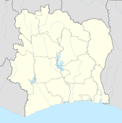
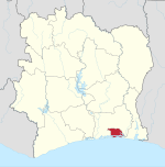
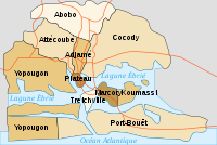
Marcory is a suburb of Abidjan, Ivory Coast. It is one of the 10 urban communes of the city. Marcory is one of four communes of Abidjan that are entirely south of Ébrié Lagoon, the others being Treichville, Koumassi, and Port-Bouët.
References[edit]
- ^ Citypopulation.de Population of boroughs and sub-prefectures of Abidjan


