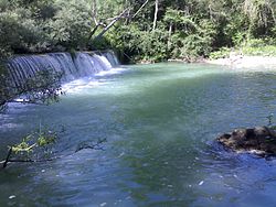
Tammaro
| Tammaro | |
|---|---|
 | |
| Location | |
| Country | Molise and Campania, southern Italy |
| Physical characteristics | |
| Source | |
| • location | Sella di Vinchiaturo |
| • elevation | 558 m (1,831 ft) |
| Mouth | Calore Irpino |
• coordinates | 41°08′48″N 14°49′55″E / 41.1466°N 14.8320°E |
| Length | 78 km (48 mi) |
| Basin size | 793 km2 (306 sq mi) |
| Basin features | |
| Progression | Calore Irpino→ Volturno→ Tyrrhenian Sea |
The Tammaro (Tàmmaro) is a river in southwestern Italy, with a length of 78 kilometres (48 mi) and catchment area of 673 square kilometres (260 sq mi).[1] It rises in the Sella del Vinchiaturo in the Apennine Mountains and is a tributary of the Calore Irpino river. In ancient times it was known by the Latin name Tamarus.
References
