
Víziváros: Difference between revisions
these can't be formatted unless they are completely bare |
Wikicringe (talk | contribs) Linked Hungary in introduction Tags: Mobile edit Mobile app edit iOS app edit |
||
| (4 intermediate revisions by 4 users not shown) | |||
| Line 1: | Line 1: | ||
{{short description|Neighborhood of Esztergom, |
{{short description|Neighborhood of Esztergom, Hungary}} |
||
{{Use dmy dates|date=April |
{{Use dmy dates|date=April 2021}} |
||
{{bareurls|date=January 2020}} |
|||
[[File:Megyeszékhely - Komárom-Esztergom megye - Esztergom.jpg|right|thumb|Castle hill]] |
[[File:Megyeszékhely - Komárom-Esztergom megye - Esztergom.jpg|right|thumb|Castle hill]] |
||
[[File:EsztergomCatholicMuseum.jpg|right|thumb|[[Christian Museum (Hungary)|Christian Museum]]]] |
[[File:EsztergomCatholicMuseum.jpg|right|thumb|[[Christian Museum (Hungary)|Christian Museum]]]] |
||
'''Víziváros''' (meaning ''Watertown'', {{lang-la|Civitas Archiepiscopalis}}, {{lang-de|link=no|Wasserstadt}}) is a neighborhood of [[Esztergom]], Hungary on the right bank of the [[Danube]], under the royal castle and the [[Esztergom Basilica|St. Adalbert Primatial Basilica]]. The name Watertown derives from the numerous [[hot springs]] in the area. |
'''Víziváros''' (meaning ''Watertown'', {{lang-la|Civitas Archiepiscopalis}}, {{lang-de|link=no|Wasserstadt}}) is a neighborhood of [[Esztergom]], [[Hungary]] on the right bank of the [[Danube]], under the royal castle and the [[Esztergom Basilica|St. Adalbert Primatial Basilica]]. The name Watertown derives from the numerous [[hot springs]] in the area. |
||
Víziváros was established by [[Matthias Rátót]], [[Archbishop of Esztergom]] in 1239. The town fell under Ottoman rule in 1543, and it was only taken back by Christian forces in 1683. During that 140 years, the Turks built baths, religious buildings and re-enforced the castle. The Öziçeli Hacci Ibrahim [[Mosque]] on Berényi Zsigmond street is the oldest still standing mosque of the [[Ottoman Empire]] along the Danube.<ref>http://www.24ora.hu/ |
Víziváros was established by [[Matthias Rátót]], [[Archbishop of Esztergom]] in 1239. The town fell under Ottoman rule in 1543, and it was only taken back by Christian forces in 1683. During that 140 years, the Turks built baths, religious buildings and re-enforced the castle. The Öziçeli Hacci Ibrahim [[Mosque]] on Berényi Zsigmond street is the oldest still standing mosque of the [[Ottoman Empire]] along the Danube.<ref>{{Cite web|url=http://www.24ora.hu/|title=24 Óra Hírlap|website=24ora.hu}}</ref><ref>{{Cite web|url=https://ingatlanok.hu/hirek/20071120/atadtak_az_ozicseli_hadzsi_ibrahim_dzsamit___kepek|title=Átadták a Hadzsi Ibrahim dzsámit - képek|website=Ingatlanok.hu}}</ref> |
||
After the siege of 1683 reconstruction of the town began, but during [[Rákóczi's War for Independence]] it was destroyed in the winter of 1705–1706. Víziváros was repopulated by Germans. In 1827 its population was 697. By 1891 the town had 1158 [[Hungarian people|Hungarian]] residents. The Cathedral Library (Bibliotheca) opened in 1853. The library building was designed by [[József Hild]]. The [[Christian Museum (Hungary)|Christian Museum]] was founded by archbishop |
After the siege of 1683 reconstruction of the town began, but during [[Rákóczi's War for Independence]] it was destroyed in the winter of 1705–1706. Víziváros was repopulated by Germans. In 1827 its population was 697. By 1891 the town had 1158 [[Hungarian people|Hungarian]] residents. The Cathedral Library (Bibliotheca) opened in 1853. The library building was designed by [[József Hild]]. The [[Christian Museum (Hungary)|Christian Museum]] was founded by archbishop [[János Simor]] in 1875, when he opened his private collection of [[religious art]] to visitors. The Primatial Palace was built in 1883. In 1895 Víziváros was merged with Royal Esztergom as third district. The same time neighboring [[Szentgyörgymező]] became fourth and [[Szenttamás (Esztergom)|Szenttamás]] became second district. |
||
<gallery> |
<gallery> |
||
Latest revision as of 01:14, 22 February 2022


Víziváros (meaning Watertown, Latin: Civitas Archiepiscopalis, German: Wasserstadt) is a neighborhood of Esztergom, Hungary on the right bank of the Danube, under the royal castle and the St. Adalbert Primatial Basilica. The name Watertown derives from the numerous hot springs in the area.
Víziváros was established by Matthias Rátót, Archbishop of Esztergom in 1239. The town fell under Ottoman rule in 1543, and it was only taken back by Christian forces in 1683. During that 140 years, the Turks built baths, religious buildings and re-enforced the castle. The Öziçeli Hacci Ibrahim Mosque on Berényi Zsigmond street is the oldest still standing mosque of the Ottoman Empire along the Danube.[1][2]
After the siege of 1683 reconstruction of the town began, but during Rákóczi's War for Independence it was destroyed in the winter of 1705–1706. Víziváros was repopulated by Germans. In 1827 its population was 697. By 1891 the town had 1158 Hungarian residents. The Cathedral Library (Bibliotheca) opened in 1853. The library building was designed by József Hild. The Christian Museum was founded by archbishop János Simor in 1875, when he opened his private collection of religious art to visitors. The Primatial Palace was built in 1883. In 1895 Víziváros was merged with Royal Esztergom as third district. The same time neighboring Szentgyörgymező became fourth and Szenttamás became second district.
-
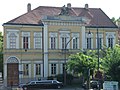
 Mindszenty square
 -
 Péter Pázmány street
 -
 Bibliotheca


References[edit]
- ^ "24 Óra Hírlap". 24ora.hu.
- ^ "Átadták a Hadzsi Ibrahim dzsámit - képek". Ingatlanok.hu.