Valle Peligna: Difference between revisions
Adding geodata: {{coord|42|04|49|N|13|53|16|E|region:IT_source:kolossus-itwiki|display=title}} |
m Bot: Migrating 2 interwiki links, now provided by Wikidata on d:q4008059 |
||
| Line 13: | Line 13: | ||
[[Category:Valleys of Italy|Peligna]] |
[[Category:Valleys of Italy|Peligna]] |
||
[[Category:Sulmona]] |
[[Category:Sulmona]] |
||
[[es:Valle Peligna]] |
|||
[[it:Valle Peligna]] |
|||
Revision as of 08:09, 21 March 2013

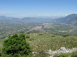
The Valle Peligna, also known as Conca di Sulmona, is a plateau in central Abruzzo, southern Italy, included in the province of L'Aquila. It has a surface of some 100 km².
The valley takes its name from the Greek term peline, meaning "muddy": this refers to prehistorical times, when it was occupied by a lake which disappeared after a series of earthquakes (the former diaphragm with the sea was in what are now the gorges of Popoli), leaving the land full of marshes but fertile. Three hills near Sulmona are the relics of the single island in the lake.
It is crossed by the rivers Aterno and Sagittario, and is bordered by the Fucino basin by east. Apart Sulmona, the main centers in the plateau include Raiano, Vittorito, Corfinio, Pratola Peligna and Pacentro.
Historically, it was inhabited by the Paeligni, who were one of the Pelasgians who came here from Asia Minor in the 12th century BC.
