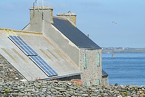
Île Béniguet
| Île Béniguet | ||
|---|---|---|
| Northeast coast | ||
| Waters | English Channel | |
| Geographical location | 48 ° 50 '33 " N , 3 ° 1' 6" W | |
|
|
||
| surface | 18 ha | |
| Highest elevation | 27 m | |
| Farm on the island | ||
The Île Béniguet is a French island in the Bretagne region and in the Côtes-d'Armor department and is located in the English Channel , off the Bretagne peninsula. It has an area of 18 hectares, its highest point is 27 meters above the sea.
Administratively, the island belongs to the municipality of Île de Bréhat .
An island of the same name is located in the Île-Molène archipelago in the Finistère department
Web links
Commons : Île Béniguet - collection of images, videos and audio files


