İznik Gölü
|
İznik Gölü ancient names: Askania Limne, Ascania Lacus |
||
|---|---|---|

|
||
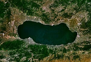
| Satellite image of the lake | ||
| Geographical location | Bursa Province ( Turkey ) | |
| Drain | Karsak Deresi → Sea of Marmara | |
| Places on the shore | İznik | |
| Data | ||
| Coordinates | 40 ° 26 ' N , 29 ° 31' E | |
|
|
||
| Altitude above sea level | 85 m | |
| surface | 298 km² | |
| length | 32 km | |
| width | 11 km | |
| Maximum depth | 82 m | |

|
||
The İznik Gölü ("İznik Lake") is located in the southeast of the Marmara region and is in the northwestern Turkish province of Bursa .
It is the fifth largest lake in Turkey and the largest in the Marmara region. In ancient times it was also called Askania Lake ( Askania Limne , Latinized Ascania Lacus ) because it was in the Askania region . It owes its current name to the place İznik (formerly Nikaia ), which is located on the eastern shore of the lake. The lake has an outflow, the Karsak Deresi , to the town of Gemlik , west of the south bank of the Marmara Sea .
Its area is 298 km². The lake is at an altitude of 85 m . The maximum width from north to south is 11 km and the length from east to west is 32 km. The deepest point is in the south of the lake and is 82 m deep.
