Ahornsee (Dachstein)
| Ahornsee | ||
|---|---|---|

|
||
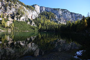
| Ahornsee from the west side, view to Kümpfling ( 1839 m ) | ||
| Geographical location | Dachstein massif , near Haus im Ennstal, Styria | |
| Tributaries | underground (from Grafenbergsee ) | |
| Drain | underground (to Gradenbach → Enns → Danube ) | |
| Data | ||
| Coordinates | 47 ° 27'59.8 " N , 13 ° 46'55.6" E | |
|
|
||
| Altitude above sea level | 1485 m above sea level A. | |
| length | 230 m | |
| width | 170 m | |
|
particularities |
||
The Ahornsee lies in the Styrian part of the Dachstein massif in the Gradenbachtal .
He lies in an endorheic basin. From above, in particular, the water of the Grafenbergsee , located 2 kilometers to the west and 150 meters higher, runs underground, and it also drains underground via the Gradenbach, which has its source at the little lake about 200 m to the southeast.
Hiking trails
- Ascent to the Grafenbergalm
- As a descent home
Web links
Commons : Ahornsee - Collection of pictures, videos and audio files
