Alaid
| Alaid | ||
|---|---|---|
|
Atlasov Island with the Alaid volcano |
||
| height | 2339 m | |
| location | Atlasov Island | |
| Coordinates | 50 ° 51 '30 " N , 155 ° 33' 0" E | |
|
|
||
| Type | Stratovolcano | |
| Last eruption | 1996 | |
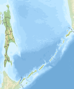
The volcanic Alaid ( Russian Алаид ) forms the Kuril -Insel Atlasov , and is the highest and northernmost volcano the island chain.
The symmetrically shaped stratovolcano has a height of 2339 meters and the summit is formed by a caldera with a diameter of 1.5 kilometers, which is broken up in the south by a wide aisle. From the bottom of the Sea of Okhotsk , the volcanic island is over 3000 meters high. Several pyroclastic cones are found on the northwest and southeast sides of the volcano, including a crater that formed in the 1933-1934 eruption.
Strong explosive eruptions in the summit crater occurred at the beginning of the 18th century. Further explosive eruptions in 1790 and 1981 (emitting 0.55 cubic kilometers of tephra ) are among the largest of the Kuril volcanoes. Historical records also show large eruptions on June 27, 1854, July 7 to 9, 1860, 1894, November 1933 to August 1934, March 29, 1982, May 1986 and December 3, 1996. During the powerful eruption on June 18 By September 11, 1972, 45 million cubic meters of lava were extracted and 0.1 cubic kilometers of tephra were expelled.
literature
- A. Gorkin and others: Geografija Rossii: Enziklopeditscheski slowar . Bolschaja Rossijskaja enziklopedija, Moscow 1997, ISBN 5-85270-276-5 , p. 20. (Russian).
Web links
- Alaid in the Global Volcanism Program of the Smithsonian Institution (English)
- Alaid at the Kamchatka Volcanic Eruption Response Team (English)

