Atlasov Island
| Atlasova | ||
|---|---|---|
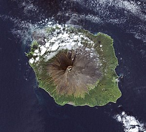
| Atlasow Island, captured by LANDSAT 7 | ||
| Waters | Sea of Okhotsk | |
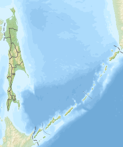
| Archipelago | Kuril Islands | |
| Geographical location | 50 ° 51 ' N , 155 ° 33' E | |
|
|
||
| surface | 119 km² | |
| Highest elevation |
Alaid 2339 m |
|
| Residents | uninhabited | |
| Atlasow Island seen from the sea | ||
The atlasov island ( Russian остров Атласова ostrow Atlassowa ; also Atlasowinsel , ostrov Atlasova , Atlasov Iceland , Uyakhuzhach, Araito , Alaid or Japanese. 阿頼度島 , Araido-tō ) is the northernmost island of the Kuril Islands and part of the Sakhalin Oblast in Russia .
The now uninhabited island consists of the Alaid volcano , which rises 2339 m above the Sea of Okhotsk . The area of the island is 119 km².
history
The island was named after Vladimir Atlasov , a Russian explorer of the 17th century.
During the Stalin era until 1953 there was a prison camp on the island in which up to 600 women were interned. A fish processing plant was given up after the end of the Soviet Union. The island has been uninhabited since then.
The Ainu settled on the Kuril Islands, which explains the Japanese name for the island. The volcano was called Oyakoba ( 親子 場 山 ). With the Treaty of Saint Petersburg in 1875 the Kuriles were ceded to Japan, but in the last days of the Second World War it was occupied and annexed by the Soviet Union .
tourism
The island is visited by cruise ships from time to time .
literature
- G. Gilbo: Sprawotschnik po istorii geografitscheskich naswani na pobereschje SSSR . Ministerstwo oborony Soiusa SSR, Glaw. upr. nawigazii i okeanografii, 1985, p. 23. (Russian)
Web links
Individual evidence
- ↑ Werner Stambach: Polartravel, Kurilen p. 23


