Makanruschi
| Makanruschi | ||
|---|---|---|
| NASA image of Makanruschi | ||
| Waters | Sea of Okhotsk | |
| Archipelago | Kuril Islands | |
| Geographical location | 49 ° 46 '48 " N , 154 ° 26' 0" E | |
|
|
||
| length | 10 km | |
| width | 7 km | |
| surface | 49 km² | |
| Highest elevation | Makanrushi 1171 m |
|
| Residents | uninhabited | |
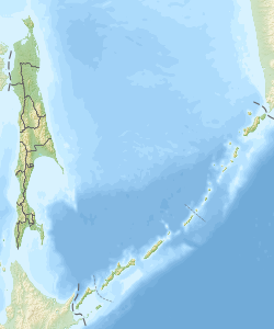
Makanruschi ( Russian Остров Маканруши ; Japanese 磨勘 留 島 , Makanrushi-tō ) is an uninhabited volcanic island in the northern part of the Kuril Islands . It is located 28 kilometers northwest of the island of Onekotan and is therefore a bit outside the actual, volcanically active arch of the Kuril Islands. Administratively, the island belongs to the Russian Oblast Sakhalin .
Makanruschi is an approximately oval-shaped island with a length of 10 km, a width of up to 7 km and an area of 49 km². It consists essentially of the same name stratovolcano and reaches a height of 1,171 meters above sea level.
literature
- East Coast of Russia Enroute . ProStar Publications, 2004, p. 56. ISBN 978-1-57785-560-6 (English)
- I. Sonn, A. Kostjanoi: Okhotskoye more: enziklopedija . Meschdunarodnyje otnoshenija, Moscow 2009, p. 110. ISBN 978-5-7133-1354-8 (Russian)
Web links
- Makanruschi on oceandots.com ( Memento from December 23, 2010 in the Internet Archive ) (English)

