Shiashkotan
| Shiashkotan | ||
|---|---|---|
| NASA image of Shiashkotan | ||
| Waters | Pacific Ocean | |
| Archipelago | Kuril Islands | |
| Geographical location | 48 ° 49 ′ N , 154 ° 6 ′ E | |
|
|
||
| length | 20.5 km | |
| surface | 122 km² | |
| Highest elevation |
Sinarka 934 m |
|
| Residents | uninhabited | |
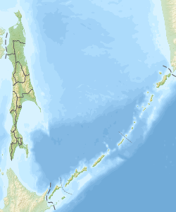
Schiaschkotan ( Russian Остров Шиашкотан ; Japanese 捨 子 古 丹 島 , Shasukotan-tō ) is an uninhabited volcanic island of the Kuriles . It is located 25 kilometers southwest of the island of Charimkotan and 8 km southeast of the island of Ekarma and administratively belongs to the Russian Oblast Sakhalin .
Schiashkotan is a double island consisting of two volcanoes , which are only connected by a narrow isthmus . The north of the island is occupied by the 934 m high Sinarka volcano , while the south is dominated by the 828 m high Kuntomintar . The island is about 20 km long and has an area of 122 km². The northern part of the island was once populated by Ainu , but the Sinarka eruption in 1872 destroyed the only village.
literature
- I. Sonn, A. Kostjanoi: Okhotskoye more: enziklopedija . Meschdunarodnyje otnoschenija, Moscow 2009, p. 203. ISBN 978-5-7133-1354-8 (Russian)
Web links
- Sinarka in the Global Volcanism Program of the Smithsonian Institution (English)
- Kuntomintar in the Global Volcanism Program of the Smithsonian Institution (English)

