Chirinkotan
| Chirinkotan | ||
|---|---|---|
| NASA image of Tschirinkotan | ||
| Waters | Sea of Okhotsk | |
| Archipelago | Kuril Islands | |
| Geographical location | 48 ° 58 '49 " N , 153 ° 29' 12" E | |
|
|
||
| surface | 9 km² | |
| Highest elevation | Tschirinkotan 724 m |
|
| Residents | uninhabited | |
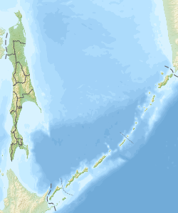
Tschirinkotan ( Russian Остров Чиринкотан ; Japanese 越 渇 磨 島 , Chirinkotan -tō ) is a volcanic island of the Russian Kuril Islands . Tschirinkotan has an area of 9 km² and is located about 30 kilometers west of Ekarma , another Kuril island of volcanic origin.
The island with a maximum height of 724 meters is the summit of a stratovolcano that rises around 3000 meters above the sea floor. The volcano last erupted in 1986 and 2004.
Web links
Commons : Tschirinkotan - Collection of images, videos and audio files
- Tschirinkotan in the Global Volcanism Program of the Smithsonian Institution (English)

