Matua
| Matua | ||
|---|---|---|
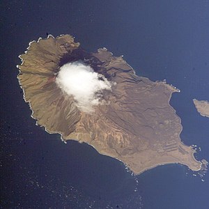
| NASA image | ||
| Waters | Pacific Ocean | |
| Archipelago | Kuril Islands | |
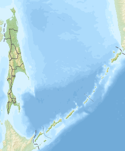
| Geographical location | 48 ° 5 '0 " N , 153 ° 14' 0" E | |
|
|
||
| surface | 52 km² | |
| Highest elevation |
Sarychev 1496 m |
|
| Residents | uninhabited | |
| NASA / ISS image of the Sarychev eruption on June 12, 2009 | ||
Matua ( Russian Матуа ; Japanese 松 輪 島 , Matsua -tō ) is an island belonging to Russia in the central Kuril group . Their area is 52 km². 30 km southwest is Rasschua ( 羅 処 和 島 , Rasutsua-tō ), 18 km northeast is the small island of Raikoke ( 雷公 計 島 , Raikoke-tō ).
Administratively, the island of Matua belongs to Sakhalin Oblast .
The stratovolcano Sarychev , one of the most active volcanoes of the Kuril Islands with an altitude of 1496 m, is located near the north-western tip of the island . After a 20-year dormant phase, a violent outbreak occurred on June 12, 2009.
tourism
The island is visited by cruise ships from time to time .
Individual evidence
- ↑ a b c 北方 領土 の 位置 と 面積 ( Eng . "Location and area of the Northern Territories"). (. No longer available online) 北方領土問題対策協会 (dt. "Society for action on the issue of the Northern Territories") [ Independent Administrative Institution of the Cabinet Office ], archived from the original on 23 February 2009 ; Retrieved July 3, 2009 (Japanese). Info: The archive link was inserted automatically and has not yet been checked. Please check the original and archive link according to the instructions and then remove this notice.
Web links
Commons : Matua - collection of images, videos and audio files
- Sarychev on Matua in the Global Volcanism Program of the Smithsonian Institution (English)
- Matua ( Memento from December 23, 2010 in the Internet Archive ) in the Insel-Encyclopedia www.oceandots.com (English)
- Spektrumdirekt, notification of the Sarychev eruption, June 24, 2009
- The Kuril Biocomplexity Project (English)


