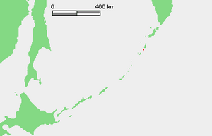
Charimkotan
| Charimkotan | |
|---|---|
| The island of Charimkotan | |
| Waters | Pacific Ocean |
| Archipelago | Kuril Islands |
| Geographical location | 49 ° 7 '0 " N , 154 ° 30' 29" E |
| surface | 68 km² |
| Highest elevation | Stratovolcano Charimkotan 1157 m |
| Residents | uninhabited |
Kharimkotan ( Russian Харимкотан , jap . 春牟古丹島 , Harimukotan-tō ; Ainu for the land of the lilies ) is the name of a to Russia belonging volcanic island in the group of the Kuril Islands , which 13 kilometers south-west of Onekotan and northeast of Ekarma and Shiashkotan is . Separated from the latter two islands by the Krenitsyn Strait , Charimkotan has a diameter of eight to thirteen kilometers and an area of 68 km².
The island was created by and consists of a stratovolcano with a maximum height of 1157 meters. The summit is formed by two horseshoe-shaped craters , which were created when the uppermost slopes collapsed. Two peninsulas in the east and north-west are the deposits of the debris avalanche that escaped . The last collapse of the volcano was in 1933 with an eruption with a magnitude of five on the volcanic explosion index (VEI). The central cone Sewergin was largely destroyed. The debris avalanche of 1933 triggered a tsunami up to nine meters high , which killed two people on the islands of Onekotan and Paramushir . During the eruption from January 8 to April 14, 1933, a lava dome was last formed , which is located in the newly formed crater.
The Sewergin got its name from Adam Johann von Krusenstern , who named part of the volcanic massif after the mineralogist, chemist and academician Vasily Michailowitsch Severgin (1765-1826) during his circumnavigation of the world in 1805 .
At the edge of the volcanic massif there are pumice stone and sulfur , on the west coast there are some pebble beaches. From 1996 to 2000 the first researches of the flora of Charimkotan were carried out by the International Kuril Island Project , in which 46 plant families with 121 genera, 182 species and 4 subspecies were recorded. With 17 finds each, the composites , sweet grasses and sour grasses were most strongly represented.
credentials
- Charimkotan in the Global Volcanism Program of the Smithsonian Institution (English)
- Botanical research on Charicotan
Individual evidence
- ↑ Sakhalin Volcanic Eruption Response Team (SVERT): Active volcanoes of the Kurile Islands - a quick reference. (English, pdf, 245 kB, accessed on March 22, 2013).
- ↑ entry in the Global Historical Tsunami Database of NOAA (English, accessed on 23 March 2013).

