Broutona
| Broutona | ||
|---|---|---|
| NASA Landsat image of Broutona | ||
| Waters | Sea of Okhotsk | |
| Archipelago | Kuril Islands | |
| Geographical location | 46 ° 43 '28 " N , 150 ° 43' 59" E | |
|
|
||
| length | 4.5 km | |
| width | 3.2 km | |
| surface | 7 km² | |
| Highest elevation | 801 m | |
| Residents | uninhabited | |
Broutona ( Russian Остров Броутона ; Japanese 武 魯 頓 島 , Buroton-tō ) is a small, uninhabited volcanic island of the Kuril Islands . Administratively it belongs to the Russian Oblast Sakhalin and is named after William Robert Broughton .
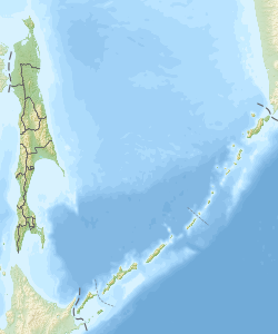
Broutona is located about 55 kilometers northeast of the island of Urup and 17 km northwest of Tschirpoi and is therefore slightly within the actual, volcanically active island arc of the Kuriles. The approximately oval-shaped island has a length of 4.5 km, a width of up to 3.2 km and an area of about 7 km². It reaches a height of around 800 m above sea level.
literature
- Igor Sonn, Andrej Kostjanoi: Okhotskoye more. Encyclopedia . Meschdunarodnyje otnoshenija, Moscow 2009, p. 31. ISBN 978-5-7133-1354-8 (Russian)
Web links
- Broutona on oceandots.com ( Memento from December 23, 2010 in the Internet Archive ) (English)

