Onekotan
| Onekotan | ||
|---|---|---|
| Krenitsyn volcano in the Tao Rusyr caldera | ||
| Waters | Pacific Ocean | |
| Archipelago | Kuril Islands | |
| Geographical location | 49 ° 27 ' N , 154 ° 45' E | |
|
|
||
| length | 42 km | |
| width | 17 km | |
| surface | 425 km² | |
| Highest elevation |
Krenitsyn 1325 m |
|
| Residents | uninhabited | |
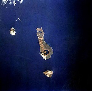
| Onekotan Island, 1994 (north about left) | ||
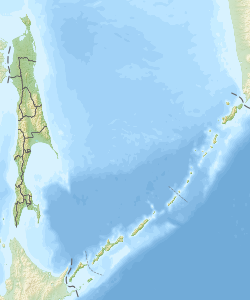
Onekotan ( Russian Онекотан ; Japanese 温 禰 古 丹 島 Onekotan-tō ) is an island belonging to Russia in the northern Kuril group . The closest islands are Makanruschi in the northwest and Charimkotan in the south.
It is of volcanic origin and forms part of the ring of fire that surrounds the Pacific . Its area is 425 km² (42 km long and 8 to 17 km wide).
Onekotan is notable for the two calderas at the south and north ends of the island. In the south of the island, which rises 1,325 meters high volcano Krenizyn from the Kolzewoje Lake ( Кольцевое translated Ringsee ), which the Tao-Rusyr Caldera fills. In the north of the island is the 1019 m high volcano Nemo , also in a caldera, which is only partially occupied by a lake ( Tschornoje Lake , Чёрное , Black Lake ).
Administratively, the island belongs to Rajon Severo-Kurilski ( Nordkurilen , with the administrative center of Severo-Kurilsk on Paramushir ) of the Sakhalin Oblast . Until about 1994 there was a site of the Russian air defense on the east coast ( Mussel Bay, бухта Муссель ) , which is also recorded on Russian maps under the name Onekotan. Before the Second World War , the island belonged to the Japanese sub-prefecture of Nemuro .
literature
- Onekotan . In: Энциклопедический словарь Брокгауза и Ефрона - Enziklopeditscheski slowar Brokgausa i Jefrona . tape 21 a [42]: Нэшвилль – Опацкий. Brockhaus-Efron, Saint Petersburg 1897, p. 950 (Russian, full text [ Wikisource ] PDF ).
Web links
- Article Onekotan in the Great Soviet Encyclopedia (BSE) , 3rd edition 1969–1978 (Russian)
- Travel report Onekotan and other Kuril Islands, 2006 (Russian, illustrated)


