Anziferow Island
| Anziferowa | ||
|---|---|---|
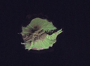
| Anziferow Island ( Landsat 7 image) | ||
| Waters | Pacific Ocean | |
| Archipelago | Kuril Islands | |
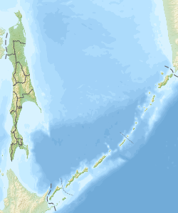
| Geographical location | 50 ° 12 ′ 0 ″ N , 154 ° 59 ′ 0 ″ E | |
|
|
||
| surface | 7 km² | |
| Highest elevation |
Schirinki 761 m |
|
| Residents | uninhabited | |
The Anziferow Island , also Schirinki ( Russian остров Анциферова / ostrow Anziferowa, Japanese 志 林 規 島 , Shirinki -tō ) is a volcanic island belonging to Russia in the northern Kuril group .
The area of the island is about 7 km² . It is approximately circular with a diameter of 3 km.
The island was named after the Russian Cossack Danila Jakowlewitsch Anziferow (* unknown, † 1712), who was ataman on Kamchatka from 1711 after the death of Vladimir Atlasov . He belonged to the first group of Russians on the islands of Paramushir and Shumshu and provided the first description of the islands. He was killed by the Itelmen .
Anziferow Island is located southwest of Paramushir , from which it is separated by the 15 km wide Third Kuril or Luzhin Strait . Luschin Street is named after the Russian geodesist and cartographer Fjodor Luschin (* unknown, † 1727). Luschin mapped Kamchatka and the Kuril Islands in 1719–1721, was active in Eastern Siberia from 1723–1724 and participated in Vitus Bering's First Kamchatka Expedition from 1725–1727 .
The island represents the 761 m high part of the extinct volcano Shirinki ( Ширинки ), which rises above sea level .
Anziferow is uninhabited. Administratively, the island belongs to Rajon Severo-Kurilsk ( Nordkurilen , administrative center of Severo-Kurilsk on Paramushir).
fauna
At the southern end of the island is one of five breeding grounds for Steller's sea lions on the Kuril Islands with around 600 animals. Fulmars , yellow-headed lobsters , rissa and thick-billed mum live there as well .
Web links
- Shirinki in the Global Volcanism Program of the Smithsonian Institution (English)

