Ketoi
| Ketoi | ||
|---|---|---|
| NASA image of Ketoi | ||
| Waters | Pacific Ocean | |
| Archipelago | Kuril Islands | |
| Geographical location | 47 ° 21 ′ N , 152 ° 29 ′ E | |
|
|
||
| length | 12 km | |
| surface | 73 km² | |
| Highest elevation | Ketoi 1172 m |
|
| Residents | uninhabited | |
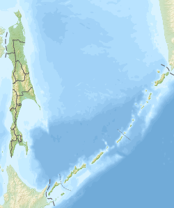
Ketoi ( Russian Кетой ; Japanese 計 吐 夷 島 , Ketoi -tō ) is an uninhabited volcanic island in the central area of the Kuril Islands , about 19 kilometers northwest of Simushir Island. Administratively, the island belongs to the Russian Oblast Sakhalin . The island is approximately round with a diameter of about 12 kilometers and an area of 73 km².
The northeast Ketois is the edge of a caldera formed in the Pleistocene with a diameter of 5 kilometers. The highest point on the island at 1172 meters above sea level is a stratovolcano in the northwest, which is cut through by a horst - ditch structure. The center of the island is occupied by an explosion crater 1.5 kilometers in diameter, in which a freshwater lake has formed.
All eruptions in historical times started from the 990 meter high Pallas Peak , a cone made of andesite , in whose 550 meter diameter crater lies a turquoise lake . A five-kilometer lava flow from Pallas Peak reached the coast in the southeast of the island. Outbreaks are known from the years 1843 to 1846, 1924 and 1960. In 1981 very active fumaroles were observed.
Web links
- Ketoi in the Global Volcanism Program of the Smithsonian Institution (English)
- Ketoi on oceandots.com ( Memento from December 23, 2010 in the Internet Archive ) (English)
Individual evidence
- ↑ Sakhalin Volcanic Eruption Response Team (SVERT): Active volcanoes of the Kurile Islands - a quick reference. (English, pdf, 245 kB, accessed on March 25, 2013).

