Ekarma
| Ekarma | ||
|---|---|---|
| Waters | Pacific Ocean | |
| Archipelago | Kuril Islands | |
| Geographical location | 48 ° 57 '29 " N , 153 ° 55' 48" E | |
|
|
||
| length | 7.5 km | |
| width | 5 km | |
| surface | 30 km² | |
| Highest elevation | 1170 m | |
| Residents | uninhabited | |
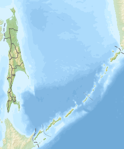
Ekarma ( Russian Экарма , Japanese 越 渇 磨 島 , Ekaruma-tō ) is a volcanic island of the Russian Kuril Islands . Ekarma lies between Schiashkotan and Tschirinkotan . It is separated from the southeastern island of Shiashkotan by the 8.5 kilometers wide Ekarma Strait . Chirinkotan is located around 30 kilometers west of Ekarma.
The island represents the part of two stratovolcanoes that have grown together . It has an extension of 7.5 × 5 kilometers with an area of 30 km². The western peak reaches a height of 1170 m.
The western volcano was active in historical times. During an eruption between 1767 and 1769, a new lava dome was created . After an eruption in 1980, the volcano became active again in 2010. Steam and ash escaped from a crack on the southwest slope ; Lahars also formed .
Politically, Ekarma belongs to the Sakhalin Oblast of the Russian Federation .
Web links
- Ekarma in the Global Volcanism Program of the Smithsonian Institution (English)

