Sarychev (volcano)
| Sarychev | ||
|---|---|---|
|
Sarychev volcano on Matua island, view from the south of Raikoke |
||
| height | 1496 m | |
| location | Sakhalin Oblast , Russia | |
| Mountains | Matua Island , Kuril Islands | |
| Coordinates | 48 ° 5 '30 " N , 153 ° 12' 0" E | |
|
|
||
| Type | Stratovolcano | |
| Last eruption | 2009 | |
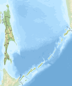
The Sarychev Peak ( Russian вулкан Сарычева , Sarychev Peak volcano ) is a stratovolcano on the Kuril -Insel Matua in the Far East of Russia . The volcano is relatively young in geological terms and shows a very symmetrical conical structure.
The mountain was named after the discoverer and officer of the Imperial Russian Navy Gavriil Sarytschew (1763-1831).
The Sarychev volcano, one of the most active volcanoes in the Kuril Islands, dominates the northwestern part of Matua Island. The Andesite central crater was formed in a caldera with a diameter of 3 to 3.5 km. More recent lava flows and deposits of pyroclastic flows cover all sides of the volcano. Eruptions have been observed since 1760, with explosive eruptions alternating with quieter lava flows. The volcano's largest historical eruption occurred in 1946, with pyroclastic currents reaching the coast.
On June 12, 2009, another eruption of the volcano began with the discharge of huge clouds of ash. Since the volcano is located near international flight routes between East Asia and North America, air traffic was partially obstructed.
literature
- Alexander Rybin, Nadezhda Razjigaeva, Artem Degterev, Kirillommeny, Marina Chibisova: The Eruptions of Sarychev Peak Volcano, Kurile Arc: Particularities of Activity and Influence on the Environment. In: Hwee-San Lim: New Achievements in Geoscience. 2012, ISBN 978-953-510-263-2 (English, PDF; 791 kB).
Web links
- Sarychev in the Global Volcanism Program of the Smithsonian Institution (English)


