Almannaskarðsgöng
| Almannaskarðsgöng | ||
|---|---|---|
|
The southern tunnel entrance
|
||
| use | Road traffic | |
| traffic connection |
Hringvegur |
|
| place | Hofn | |
| length | 1312 m | |
| vehicles per day | 662 | |
| Number of tubes | 1 | |
| construction | ||
| start of building | 2004 | |
| completion | 2005 | |
| business | ||
| operator | Vegagerðin | |
| location | ||
|
|
||
| Coordinates | ||
| North portal | 64 ° 17 ′ 31 ″ N , 15 ° 1 ′ 41 ″ W. | |
| South portal → Höfn | 64 ° 16 ′ 58 " N , 15 ° 0 ′ 42" W. | |
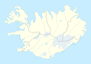
The Almannaskarðsgöng are a road tunnel in the east of Iceland a few kilometers east of Höfn on the ring road ![]() .
.
The tunnel was opened in 2005 after a year of construction and is 1312 meters long. The tunnel crosses under and replaces the Almannaskarð , a 153 meter high pass. Despite the low altitude, the pass road was closed again and again from autumn to spring and even very often in winter, which interrupted practically the only road connection to the east of Iceland from Reykjavík (the only alternative was the northern ring road via Akureyri , which was a detour of many hundreds of kilometers). The old pass road was also narrow, only gravel and very steep with a gradient of up to 17%.
The tunnel has two lanes and is illuminated. The north portal is 82 meters above sea level, the south portal 39 meters, which corresponds to a gradient of 4.6%. In 2018, the annual average traffic volume was 662 vehicles per day.
See also
Web links
Individual evidence
- ↑ a b Jarðgöng á vegakerfinu. Retrieved January 11, 2020 (Icelandic).


