Andrimont
| Andrimont | ||
|---|---|---|
|
|
||
| State : |
|
|
| Region : | Wallonia | |
| Province : | Liege | |
| District : | Verviers | |
| Coordinates : | 50 ° 37 ' N , 5 ° 53' E | |
| Area : | 9.54 km² | |
| Post Code: | 4821 | |
| Prefix: | 087 | |
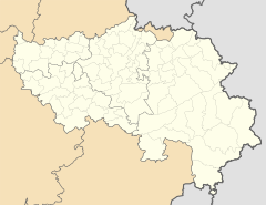
Andrimont is part of the Belgian municipality of Dison in the Wallonia region in the province of Liège , in the immediate vicinity of the city of Verviers . Until the municipality merger in 1977 Andrimont was an independent municipality.
history
Andrimont was built near the course of the historic road from Tongeren to Trier , in the vicinity of which Gallo-Roman tombs and other finds were discovered. Before 1798, Andrimont belonged to the Principality of Liège and its margravate Franchimont (marquisat de Franchimont). From 1322 the glory belonged to the godefroid, sire d'Andrimont. The current Andrimont Castle dates from the 17th century. The Saint Laurent Church was remodeled in 1606, but the tower is much older. In 1730 Andrimont was raised to its own parish.
Until the end of the 1960s, the lower-lying part of the village along the Weser was dominated by textile industry companies.
The Cité de l'espoir residential and care center is located on the outskirts of the village and can accommodate up to 310 people with disabilities.

