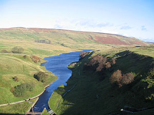
Angram Reservoir
| Angram Reservoir | |||||
|---|---|---|---|---|---|
|
|||||
|
|
|||||
| Coordinates | 54 ° 10 '50 " N , 1 ° 56' 22" W | ||||
| Data on the structure | |||||
| Height of the barrier structure : | 61 m | ||||
| Data on the reservoir | |||||
| Water surface | 34 ha | ||||
| Storage space | 4th 736 000 m³ | ||||
The angram reservoir (Angram reservoir) is close to the source of the River Nidd in the Nidderdale Area of Outstanding Natural Beauty ( AONB ) in the county of North Yorkshire in the north of England situated reservoir .
The Angram Reservoir, like the downstream Scar House Reservoir, was created to provide drinking water for the Bradford region . The transport there takes place via the Nidd Aqueduct .
The structure was completed in 1919. With a dam height of 61 meters, a maximum water depth of 33.4 meters and a water capacity of 4.736 million m³, the lake covers an area of 34 hectares.
The area is visited by over 150,000 tourists annually.
Web links
Commons : Angram Reservoir - collection of images, videos and audio files

