Anse Etoile
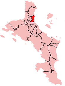
Anse Etoile (German: Bay [of] the star ) is an administrative district of the Seychelles on the island of Mahé . The district borders the metropolitan districts of Greater Victoria to the south and east.
geography
The district is located on the east coast of the northeastern tip of Mahé and is bordered by the heights of Glacis in the north and the mountains of Beau Vallon (with the settlement of Anse Etoile) in the southwest. The places La Gogue , Maldive Village , Ma Constanze and De Quincy are located in the valley between the two elevations, which is open to the east. The La Rivière Anglaise district borders to the south and there is a point contact with the Mont Buxton district in the south.
The coastline is shaped by the offshore islands.
The district has ISO 3166-2 code SC-03.
Individual evidence
Coordinates: 4 ° 36 ' S , 55 ° 27' E

