Araure
| Araure | ||
|---|---|---|
|
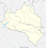
Coordinates: 9 ° 34 ′ N , 69 ° 13 ′ W Araure on the map of Portuguesa
|
||
| Basic data | ||
| Country | Venezuela | |
| State | Portuguesa | |
| City foundation | July 6, 1694 | |
| Residents | 111.908 | |
| Detailed data | ||
| surface | 2001 km 2 | |
| Population density | 56 people / km 2 | |
| Post Code | 3303 | |
| prefix | (+58) 255 | |
| Time zone | UTC -4: 30 | |
Araure is a Venezuelan city, the administrative seat of the district of Araure , in the state of Portuguesa .
history
During a trip to Spain in 1692, the Capuchin Fray Ildefonso de Zaragoza presented a petition to the King for support in building a mission for the various Indian tribes of this Llanos region. The Consejo de Indias has investigated the case and the King has given its approval.
The captain general of the province of Venezuela commissioned José Ramírez de Arellano with his troops to accompany Ildefonso de Zaragoza and to help with the establishment of a village.
On December 5, 1813, the Araure battle took place near Araure. At the “Laguna de los Muertos” (Dead Sea) the independence troops were able to defeat the royal army.
economy
Araure's main activities revolve around agriculture in the region.
Attractions
- El Túmulo - Memorial to the Araure Battle of 1813
- Mitar Nackichenovich reserve
- Raúl Leoni Park
- Los Gavilanes and Las Dos Boscas: Caves of the Araure stream
