Arizona State Route 68

|
|
|---|---|
| map | |

|
|
| Basic data | |
| Overall length: | 28 mi / 45 km |
| Starting point: |
|
| End point: |
|
| County: | Mohave County |
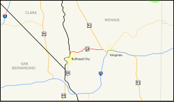
The Arizona State Route 68 is a state highway in the US state of Arizona , the West-East direction is in.
The State Route begins on Arizona State Route 95 near Bullhead City and ends west of Kingman on US Highway 93 . It used to extend to Davis Dam , this section is now called Mohave County Road 68. Until the construction of the Hoover Dam and the main goal of the State Route was the connection of the city of Laughlin in the state of Nevada to the west. Now it also serves as a bypass for trucks around the Hoover Dam.
See also
Web links
- Arizona Roads (English)