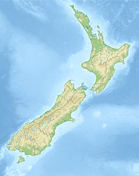
Arthur's Pass earthquake of 1929
| Arthur's Pass earthquake of 1929 | ||
|---|---|---|
|
|
||
| Coordinates | 42 ° 50 '24 " S , 171 ° 49' 48" O | |
| date | March 9, 1929 | |
| Time | 10:50 p.m. local time | |
| intensity | 9 on the MM scale | |
| Magnitude | 7.1 M S | |
| depth | 11 km | |
| epicenter | Arthur's Pass | |
| country | New Zealand | |
| Affected places |
Settlements at Arthur's Pass |
|
| Tsunami | No | |
The Arthur's Pass earthquake of 1929 had a destructive force due to its shallow depth and its magnitude 7.1 M S , which was specified in the area of the epicenter as 9 MM . Since the earthquake occurred in a very sparsely populated area of New Zealand, the damage was mostly limited to broken chimneys and water tanks. However, due to the damage, the road and rail connections to the west coast were interrupted for months.
Quake
The quake that occurred on March 9, 1929 lasted 4 minutes and created a new fault in the northeast trending fault zone, which was later called the Poulter Fault . Over a distance that was possibly between 16 and 36 km, fractures occurred on the surface that could be offset by up to 4 meters. Numerous landslides were the result.
The earthquake at Arthur's Pass was the largest earthquake since the North Canterbury earthquake of 1888 . But only three months later the Murchison earthquake of 1929 followed , which resulted in far greater destruction and also claimed deaths.
See also
literature
- Kelvin, Berryman, Pilar Villamore : Surface rupture of the Poulter Fault in the 1929 March 9 Arthur's Pass earthquake, and redefinition of the Kakapo Fault, New Zealand . In: The Royal Society of New Zealand (Ed.): New Zealand Journal of Geology & Geophysics . Vol. 47. Wellington 2004, pp. 341-351 , doi : 10.1080 / 00288306.2004.9515060 (English).
Web links
- The 1929 Arthur's Pass and Murchison earthquakes . Te Ara - the Encyclopedia of New Zealand,accessed September 7, 2010.
- M 7.1, Arthur's Pass, 9 March 1929 . GeoNet - GNS Science ,accessed on April 5, 2013(English).
