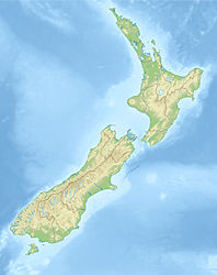
North Canterbury earthquake of 1888
| North Canterbury earthquake of 1888 | ||
|---|---|---|
|
|
||
| Coordinates | 42 ° 36 ′ 0 ″ S , 172 ° 24 ′ 0 ″ E | |
| date | September 1, 1888 | |
| Time | 04:15 | |
| intensity | 9 on the MM scale | |
| Magnitude | 7.1 M W | |
| depth | 15 km | |
| epicenter | Hope Fault
(southwest of Hanmer Springs )
|
|
| country | New Zealand | |
| Affected places | ||
| Tsunami | No | |
| dead | 0 | |
The North Canterbury earthquake of 1888 on the South Island of New Zealand was a large-scale earthquake that differed from previous quakes in New Zealand due to its three-week fore- quake .
geography
The Hope Fault , in which the 30 km long center of the quake was located, is part of the Marlborough Fault Zone on the South Island of New Zealand. The fault begins on land north of Kaikoura and runs southwest on the southeastern edge of the Seaward Kaikoura Range , passes Hanmer Springs and ends shortly before the Alpine Fault .
The quake
At about 4:15 a.m. on September 1, 1888, a 7.1 magnitude earthquake struck the North Canterbury region for 40 to 50 seconds (other sources indicate 7.0–7.3). The peculiarity of this quake was its very long announcement, because before the main quake there were noisy foreshocks for three weeks, which were heard by the residents of the region as a distant rumble. On August 30th, from 6:20 p.m. to 10:00 p.m., tremors were felt in Hope Valley , which increased in intensity . Clocks stopped and bells struck in Canterbury and West Coast . In the late evening of the following day, August 31, the earthquakes started again and increased in intensity and volume in an uncomfortable way until the main earthquake on September 1. The main quake was felt from New Plymouth on the North Island to Invercargill on the southern tip of the South Island.
During the earthquake in Hope Valley, the center of the quake, the ground shifted fences by up to 2.6 meters laterally, houses made of stone or clay were seriously damaged and numerous landslides were triggered. The Percival River in the Hanmer Plains was flanked by cracks and four new springs were formed in Otira Gorge , which received the strongest tremors in the west. Liquefaction of the soil was also observed in some cases .
The quake caused building damage over a long distance, including in Christchurch , 100 km away , where the upper, 8 m long part of the steeple was brought down, so that Christchurch lost part of its landmark for a while.
See also
literature
- Nicola McCloy : New Zealand Disasters . Whitcoulls Ltd. , Auckland 2004, ISBN 1-877327-34-4 (English).
- HA Cowan : The North Canterbury earthquake of September 1,1888 . In: Journal of the Royal Society of New Zealand . Volume 21, Number 1 , 1991, ISBN 1-877327-34-4 , pp. 1-12 (English).
Web links
- Story: Historic earthquakes - The 1888 North Canterbury earthquake . Te Ara - The Encyclopedia of New Zealand,accessed March 4, 2010.
Individual evidence
- ^ M 7.0-7.3, North Canterbury, September 1, 1888 . GeoNet - GNS Science , accessed on April 5, 2013 (English).
