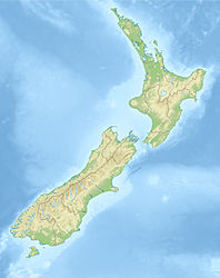
1929 Murchison earthquake
| 1929 Murchison earthquake | ||
|---|---|---|
|
|
||
| Coordinates | 41 ° 33 ′ 0 ″ S , 172 ° 15 ′ 0 ″ E | |
| date | June 17, 1929 | |
| Time | 10:17 | |
| intensity | 10 on the MM scale | |
| Magnitude | 7.8 M S | |
| depth | 12 km | |
| epicenter | Lyell Range
(west of Murchison)
|
|
| country | New Zealand | |
| Affected places | ||
| Tsunami | No | |
| dead | 17th | |
| damage | NZ $ 236 million | |
The 1929 Murchison Earthquake , as Buller earthquake known, found in the region West Coast on the South Island of New Zealand instead and was so violent that the shock wave could be perceived almost all of New Zealand.
geography
The center of the quake was in the Lyell Range , near the small town of Murchison (in the Tasman region ) and about 60 km east of Westport . The White Creek Fault , which forms part of the Lyell Range and was considered inactive up to that point, shifted horizontally and vertically.
The quake
On June 17, 1929 at around 10:17 in the morning, after more than half an hour of smaller foreshocks had been registered, the earth came up with violent up and down movements. The earthquake with a magnitude of 7.8 pushed the ground at the break edge by 2.1 m sideways and 4.5 m vertically upwards. The vertical movements were so violent that people were thrown on the ground and felt seasick . It was reported that the noise of the quake, sounding like rolling thunder, could be heard over 100 km, according to some sources even as far as the Taranaki region .
17 people were killed, most of them from landslides . The center of the quake, in the Buller River valley around Murchison, was cut off from the outside world. Numerous landslides, broken roads and paths and blocked rivers made access impossible. The only road through the valley of the Buller River was at the breakline of the fault z. B. interrupted by a 2 m high wall. Twelve hours after the quake, and after a nine-hour march, a messenger reached Glenhope , just 25 miles west upriver , for help. It was winter and storm, rain and cold gave the people additional problems. They slept in tents or in sheds and lacked food. After five days, the residents of Murchison and the surrounding area were finally evacuated and safely brought to Nelson .
It took 18 months to repair Buller Gorge Road , now known as New Zealand State Highway 6 . Until then, Westport and Reefton could only be reached by horse.
The total cost of the damage was estimated at NZ $ 236 million .
See also
literature
- Nicola McCloy : New Zealand Disasters . Whitcoulls Ltd. , Auckland 2004, ISBN 1-877327-34-4 (English).
- Rebecca Ansell, John Taber : Caught in the Crunch - Earthquakes and Volcanoes in New Zealand . Harper Collins Publishers (NZ) Ltd. , Auckland 1996, ISBN 1-86950-201-9 (English).
Web links
- Story: Historic earthquakes - The 1929 Arthur's Pass and Murchison earthquakes . Te Ara - The Encyclopedia of New Zealand,accessed March 4, 2010.
Individual evidence
- ↑ M 7.3 Buller (Murchison) Mon, Jun 17 1929 . GeoNet - GNS Science , accessed on August 11, 2017 .
- ↑ a b New Zealand Disasters - Murchison Earthquake . Christchurch Library , accessed March 4, 2010 .
- ↑ Inangahua quake left $ 39 million insurance bill - 05/24/1998 . GNS Science , January 12, 2010, accessed August 11, 2017 .
