Buller River
| Buller River | ||
|
Buller River at Buller Gorge |
||
| Data | ||
| location | South Island , New Zealand | |
| River system | Buller River | |
| source |
Lake Rotoiti 41 ° 48 ′ 10 ″ S , 172 ° 49 ′ 21 ″ E |
|
| Source height | 620 m | |
| muzzle | at Westport in the Tasman Sea Coordinates: 41 ° 43 ′ 38 ″ S , 171 ° 35 ′ 18 ″ E 41 ° 43 ′ 38 ″ S , 171 ° 35 ′ 18 ″ E |
|
| Mouth height | 0 m | |
| Height difference | 620 m | |
| Bottom slope | 3.5 ‰ | |
| length | 177 km | |
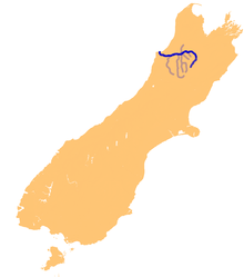
The Buller River ( Māori Kawatiri ) is a river on the South Island of New Zealand .
geography
As one of the longest rivers in New Zealand, it flows 170 km from Lake Rotoiti through two gorges, Upper Buller Gorge and Lower Buller Gorge . West of Westport the Buller River flows into the Tasman Sea . Since Lake Rotoiti is in turn fed by the Travers River , the source of the Buller River can be found on the upper reaches of the Travers River on the northern slopes of Mount Travers in the Saint Arnaud Range .
The State Highway 6 follows the river over a large part of its course, but far above the riverbed. The Paparoa Range separates the Buller River from the Gray River .
Origin of name
The Buller River was named after the member of parliament and director of the New Zealand Company , Walter Buller .
Data and usage
The Buller River has an average discharge of 429 m³ / s and the highest maximum flow with a flood of all New Zealand rivers of over 14,000 m³ / s.
The river above Murchison, together with the Mangles River, is a popular area for white water kayaking and fishing.
Tributaries
The Buller River has several major tributaries. These are (from Lake Rotoiti ) the Gowan River , Matakitaki River , Maruia River, and the Inangahua River . Smaller tributaries are the Hope River , Owen River , Mangles River , Matiri River , Blackwater River, and the Ohikanui River .
In July 2001, a Water Conservation Order came into effect for the river , which aims to preserve the river and its tributaries in their natural state.
Web links
Individual evidence
- ↑ a b Coordinates and longitudes were determined using Goggle Earth Pro Version 7.3.1.4507 on September 29, 2018
- ^ Upper Buller . Land Air Water Aotearoa , accessed September 29, 2018 .
- ^ Marian Hobbs : Water Conservation Order for Buller River to take . Beehive , June 21, 2001; archived from the original on September 29, 2007 ; accessed on August 8, 2014 .
- ^ Making the Buller River water conservation order . Ministry for the Environment , accessed April 21, 2018 .

