Ashūradeh
| Ashūradeh | ||
|---|---|---|
| Remnants of an old railroad | ||
| Waters | Caspian Sea | |
| Geographical location | 36 ° 54 '28 " N , 53 ° 59' 19" E | |
|
|
||
| length | 5.8 km | |
| width | 2 km | |
| surface | 8 km² | |
| Highest elevation | 2 m below sea level | |
| Residents | uninhabited | |
Aschūradeh , also Aschur-Ade ( Persian آشوراده, Russian Ашур-Ада Ashur-Ada ), is an island in the Caspian Sea .
Geographical location
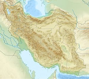
The island is located opposite the eastern end of the Miankaleh Peninsula, northeast of the Gorgan Bay named after the Golestan capital Gorgan , near the Iranian coast. It belongs to the district of Behschahr in the far east of the province of Māzandarān . Ashūradeh was separated from the peninsula by a canal. It is the only island in the Caspian Sea belonging to Iran.
The island measures a total of 800 hectares . It reaches a height of 26 meters above the Caspian Sea, which is 28 meters below sea level. Only three kilometers away on the mainland is Bandar-e Torkaman , from where the island can be reached. The island is at the center of Persian caviar production .
history
Around 300 families used to live on the island. The settlements are now devastated and orphaned. Bandar-e-Torkaman took in around 500 former residents of Ashuradeh, as their houses were flooded and had to be abandoned due to the increased level of the Caspian Sea. In 1837, Russian forces occupied the island, despite massive protests from Persia. Although the Russian fleet had been asked for support by Iran because the region was placed in uncertainty by Turkmen pirates, the army of Tsarist Russia took this opportunity to set up a military post on the island for decades. On the one hand, it was feared that they would have to defend themselves against potential attacks by Iranian and Turkmen landowners , but in particular their own trade relations should be expanded. Only on February 26, 1921 was the island bindingly returned to Iran.
The decade from 1940 to 1950 was characterized by the fact that the water between the island and the mainland became very shallow and a footpath could be opened over a sandbank. This is due to the fact that the coast of Torkaman has the slightest gradient in the entire Iranian Caspi coast.
Trivia
The name of the island has nothing to do with the Shiite Ashura festival.
Web links
- Guive Mirfendereski, A diplomatic history of the Caspian Sea: treaties, diaries, and other stories in the Google book search
Individual evidence
- ↑ Russian occupation in Google Book Search
- ↑ Hooshang Amirahmadi, The Caspian region at a crossroad: challenges of a new frontier of energy and development in the Google book search
- ↑ Peter Kerber, Iran: Islamic State with a culture that is thousands of years old in the Google book search
- ^ Igor S. Zonn, Andrey Kostianoy, Aleksey N. Kosarev, Michael Glantz, The Caspian Sea Encyclopedia , p. 26 in the Google book search
- ↑ Colonel Stebnitzky's Report on His Journey in 1872
- ↑ Yaghowb Peyvastehgar, dissertation on the topic: Development of strategies and measures for regional planning in the Iranian provinces of Gilan and Mazandaran to cope with the destruction and loss of land caused by the rise of the Caspian Sea p. 218

