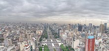
Avenida 9 de Julio
The Avenida 9 de Julio (pronounced "Nueve de Julio") is one of the main arteries of Buenos Aires . With her name she commemorates the day of the independence of Argentina (July 9, 1816).
description
The street, which was planned in 1888, was not started until 1935 and opened on October 12, 1937, for which 40 houses had to give way. At 140 meters it was the widest street in the world until 1960 , when it was replaced by the Brazilian Eixo Monumental . However, that was not entirely correct even then: The actual Avenida 9 de Julio runs on both sides of a green central lane with seven lanes in each direction. The Cerrito (north of Av. Rivadavia) and Lima (in the southern part) run in the west, separated by a wide, tree-lined green strip, and the Carlos Pellegrini (in the north) and Bernardo de Irigoyen (in the south) in the east. These two parallel streets are each three-lane one-way streets, so they are often perceived as part of Avenida 9 de Julio.
For the construction of the street, a complete row of blocks of houses in the city laid out in a checkerboard pattern was demolished, so the total width of the three streets together corresponds to that of a block of houses typical for Buenos Aires (approx. 110 meters) plus the streets flanking it, and is therefore around 140 Meter.
Crossing the three streets often takes at least 2 minutes as all intersections have traffic lights. At normal walking speed, you need two to three traffic light phases to cross the streets. City planners have already published project sketches that envisage moving the central part of the street underground.
The Avenida was planned back in 1888, when it was still to be called Ayohuma . However, due to resistance from residents and landowners, construction did not begin until 1935. The first section was inaugurated on July 9, 1937, and it was completed in 1960. The southern connections were only completed after 1980.
Avenida 9 de Julio runs from Retiro , in the north of Buenos Aires, to the Constitución train station in the south of the city. The north end connects to the Arturo Illia Expressway, which leads to Aeroparque Newbery . The southern end connects to the 25 de Mayo Expressway and Ezeiza Airport .
The main attractions along the Avenida are (from north to south):
- French Embassy: It could be saved from demolition as it is considered an architectural masterpiece
- Brazilian embassy: architecturally valuable, on the eastern side
- Colon Theater
- The western end of Lavalle Street (formerly known for its movie theaters)
- Buenos Aires Obelisk
- Statue of Don Quixote at the intersection with Avenida de Mayo
- The former “Ministerio de Desarrollo Social” at the intersection of Moreno Street
- The Constitución train station and the Plaza Constitución
Local transport
Line C of the subway runs partially under the Avenida. Lines A, B, D and E have stations on the Avenida. Lines B, C and D also stop at a common stop under the obelisk. This station is thus a central point in the city's subway network, and an underpass also serves as a commercial gallery. The subway stations on Avenida 9 de Julio are called "Carlos Pellegrini", "Diagonal Norte" and "9 de Julio".
Web links
Coordinates: 34 ° 36 ′ 28 " S , 58 ° 22 ′ 53" W.


