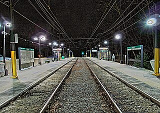
Riverside – Newton Highlands railway line
| Riverside MA-Newton Highlands MA | |||||||||||||||||||||||||||||||||||||||||||||||||||||||||||||||||||||||||||||
|---|---|---|---|---|---|---|---|---|---|---|---|---|---|---|---|---|---|---|---|---|---|---|---|---|---|---|---|---|---|---|---|---|---|---|---|---|---|---|---|---|---|---|---|---|---|---|---|---|---|---|---|---|---|---|---|---|---|---|---|---|---|---|---|---|---|---|---|---|---|---|---|---|---|---|---|---|---|
|
Waban station
| |||||||||||||||||||||||||||||||||||||||||||||||||||||||||||||||||||||||||||||
| Route length: | 5.33 km | ||||||||||||||||||||||||||||||||||||||||||||||||||||||||||||||||||||||||||||
| Gauge : | 1435 mm ( standard gauge ) | ||||||||||||||||||||||||||||||||||||||||||||||||||||||||||||||||||||||||||||
| Dual track : | entire route | ||||||||||||||||||||||||||||||||||||||||||||||||||||||||||||||||||||||||||||
| Society: | MBTA (tram) | ||||||||||||||||||||||||||||||||||||||||||||||||||||||||||||||||||||||||||||
|
|||||||||||||||||||||||||||||||||||||||||||||||||||||||||||||||||||||||||||||
The railway Riverside Newton Highlands is a former railway - and today's light rail route in Massachusetts ( United States ). It is 5.3 kilometers long and connects the city of Newton to the Boston – Worcester railway line . The standard-gauge line belongs to the Massachusetts Bay Transportation Authority , which operates the Green Line D , a double-track light rail line, on it. Rail traffic on the route has been shut down.
history
After the Boston and Albany Railroad had acquired the Brookline – Newton Highlands section in 1883, they wanted to establish a connection to the main line in order to be able to carry out a ring operation. In May 1886, the connecting line from Riverside on the Boston & Albany Main Line to Newton Highlands was opened as a double-track line from the start. Suburban trains from Boston traveled the route via Brookline or the main line as a ring in both directions. With the takeover of Boston & Albany in 1900 by the New York Central and Hudson River Railroad (later New York Central Railroad) initially only the owner changed, the management remained with Boston & Albany.
All traffic on the route ceased on June 1, 1958. Immediately afterwards, the Metropolitan Transit Authority built the light rail line from the Kenmore Tunnel Station to Brookline and on to Riverside. The new “Riverside” terminus for the light rail and the line's depot were built on Grove Street. The remaining stations were converted into light rail stations. The light rail went into operation on July 4, 1959. The section from the depot entrance to the Boston & Albany main line was still served in freight traffic until 1976 and then closed.
Route description
The line branched off at the former Riverside station from the Boston – Worcester line in the southeast. It is shut down in this area. The extensive track systems of the depot, which is located south of the line, branch off in front of today's Riverside end of the tram. The route is developed without intersections. It runs nearly straight toward Newton and opens at the branch point Cook Street Junction in the railroad track Back Bay Harrisville one, whose northern section of the rail line to Brookline continues. Apart from the overpasses and underpasses, there are no bridges or tunnels.
passenger traffic
In 1901, after the takeover by the New York Central and Hudson River Railroad and after the opening of the Boston South Station, 28 trains left this station via Newton to Riverside in each direction on weekdays and seven on Sundays. After the First World War, rail passenger traffic collapsed more and more as the volume of traffic shifted more and more to the road. 1945 ran via Newton to Riverside from Monday to Friday 16, Saturday 14 and Sunday five trains. In 2012, the Green Line D trams run every 6 minutes during rush hour, every 11 minutes on weekdays and every 10 minutes on weekends and every 8 minutes on Saturday afternoons.
Sources and further reading
- Individual evidence
- ↑ see timetables of the route from the years mentioned.
- ↑ MBTA timetable for the underground and light rail lines (PDF; 66 kB)
- literature
- Ronald D. Karr: The Rail Lines of Southern New England. A Handbook of Railroad History. Branch Line Press, Pepperell, MA 1995. ISBN 0-942147-02-2
- Mike Walker: Comprehensive Railroad Atlas of North America. New England & Maritime Canada. (2nd edition) SPV-Verlag, Dunkirk (GB), 2010. ISBN 1-874745-12-9
