Balham (London)
| Balham | ||
|---|---|---|
| Balham High Road | ||
| Coordinates | 51 ° 27 ′ N , 0 ° 9 ′ W | |
| OS National Grid | TQ285735 | |
|
|
||
| Residents | 14,751 | |
| administration | ||
| Post town | LONDON | |
| ZIP code section | SW12 | |
| prefix | 020 | |
| Part of the country | England | |
| London Borough | Wandsworth | |
| British Parliament |
Battersea Tooting |
|
| Website: http://www.balham.com/ | ||
Balham is a district of the borough of Wandsworth, south of the Thames , in west London .
location
Balham borders on Clapham to the north , Streatham to the east, Tooting to the south and the 'Between the Commons' district, which is part of Wandsworth Town , to the west . The London delivery district SW12, which is commonly equated with Balham, also includes the Hyde Farm district in the neighboring district of Lambeth , while the Balham area south of the train station belongs to the SW17 delivery district.
history
Balham is mentioned as Belgeham in the Domesday Book (1086) . At the time the manor was owned by Geoffrey Orlateile and comprised 1.5 acres of arable land and 8 acres of pasture land, from which he drew an annual income of two pounds. As an old Saxon settlement on the Roman road from London to Chichester called Stane Street , Balham can be found as Ballam , Balham Hill or Balham Manor on maps of the 17th century. At the time, the majority of the parish belonged to the parish of Streatham , while the northern part was in the parish of Battersea . The boundary between Clapham and the part of Balham, which was part of Battersea at the time, was built as a ditch and can still be traced as a ground monument in Clapham Common .
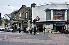
In the 19th century, Balham was initially dominated by the country estates of wealthy townspeople, while sustainable settlement activity and development only began with the opening of the station on the line to Crystal Palace (1856). Today Balham is largely characterized by the terraces that are typical of the London outskirts and are mostly two-story terraces, which are also three-story terraces on the main streets , which in the so-called Nightingale Triangle break up into free-standing properties. Most of the buildings date from before the Second World War . Some of the more recent social buildings known as estates are also typical of Balham . With the opening of the railway line to East Croydon , which branches off to the south behind the station, and the extension of the Northern Line of the London Underground beyond Clapham Common to Morden , Balham also gained in importance as an important hub in public transport. Hit by a German aerial bomb, 64 people drowned in the underground station in 1940, a memorial plaque in the counter area commemorates them.
Since the early 1990s, Balham has enjoyed increasing popularity as a place to live with both young professionals and families looking to be close to several good public schools. Since then, Balham has lost much of its dirty image ( Bedford Hill was the proverbial London suburb for years ) , which is also due to its location between Clapham Common , Wandsworth Common , Tooting Bec Common and Tooting Gaveney Common, all within walking distance .
In addition to Hammersmith , a second Polish settlement center has been established in Balham, whose members meet at the White Eagle Club and celebrate their services in the Christ the King church opposite . There is a mosque over a furniture store on Balham High Road .
Individual evidence
- ^ Ethnic Group, 2011 (QS201EW) ( English ) Office for National Statistics. January 30, 2013. Retrieved November 7, 2013.
Web links
- Official website (English)


