
Ball (moon crater)
| ball | ||
|---|---|---|

|
||
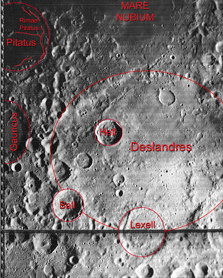
| Ball (bottom left) and surroundings ( LROC- WAC) | ||
|
||
| position | 35.92 ° S , 8.49 ° W | |
| diameter | 40 km | |
| Card sheet | 112 (PDF) | |
| Named after | William Ball (1627-1690) | |
| Named since | 1935 | |
| Unless otherwise stated, the information comes from the entry in the IAU / USGS database | ||

Ball is an impact crater in the rugged southern highlands of the moon . It lies between the Gauricus craters in the east and Lexell in the northwest on the edge of the heavily eroded Deslandres crater . Further to the south-southwest is the striking Tycho Crater .
Ball is circular and without significant traces of erosion . The inner walls are rough and a relatively large central peak rises in the center of the crater floor.
| Letter | position | diameter | link |
|---|---|---|---|
| A. | 34.7 ° S , 9.48 ° W | 29 km | [1] |
| B. | 36.92 ° S , 9.28 ° W | 10 km | [2] |
| C. | 37.68 ° S , 8.89 ° W | 31 km | [3] |
| D. | 35.58 ° S , 10.48 ° W | 20 km | [4] |
| E. | 36.53 ° S , 8.26 ° W | 5 km | [5] |
| F. | 36.93 ° S , 8.6 ° W | 12 km | [6] |
| G | 37.72 ° S , 10.3 ° W | 27 km | [7] |
Web links
- Ball in the Gazetteer of Planetary Nomenclature of the IAU (WGPSN) / USGS
- Crater Ball in the Digital Lunar Orbiter Photographic Atlas of the Moon , image iv_112_h3
- Crater Ball in the Digital Lunar Orbiter Photographic Atlas of the Moon , image iv_119_h3