Banovo
| Banovo | ||
|
|
||
| Basic data | ||
|---|---|---|
| State : |
|
|
| County : |
|
|
| Municipality : | Vrbovec | |
| Height : | 119 m. i. J. | |
| Area : | 0.69 km² | |
| Residents : | 113 (2011) | |
| Population density : | 164 inhabitants per km² | |
| Telephone code : | (+385) 01 | |
| Postal code : | 10340 Vrbovec | |
| License plate : | ZG | |
| Structure and administration | ||
| Community type : | Village | |
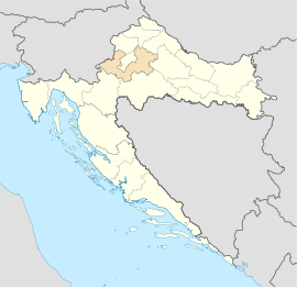
Banovo is a village with 113 (as of 2011) inhabitants in northern Croatia .
geography
The Velika stream flows on the edge of the village . The closest neighboring villages to Banovo are: Lovrečka Velika (north), Kućari (east), Lovrečka Varoš (west) and Vrbovečki Pavlovec (south). Banovo is located northeast of the municipal capital Vrbovec.
history
The village has been called "Banovo" since 1910 (in German: belonging to the prince). At that time, the Zagorci who moved there bought the former princely land and gave the village its name.
The village was previously called "Prnjarevac" when it belonged to the Lovrečina Grad Principality , until it was renamed "Imbiovec" from 1850 to 1880. And from 1880 to 1890 the village was named "Mala Lovrečina". Previously, the prince's servants and workers lived in the village. Croatians make up the local population .
Infrastructure
After the Second World War in what was then socialist Yugoslavia , a four-year primary school was built in the village. Banovo is a typical street village .
Sports
- NK Ban Jelačić Banovo , football (2. ZŽNL East)
literature
- Knjiga: "Narodnosni i vjerski sastav stanovništva Hrvatske, 1880–1991: po naseljima, author: Jakov Gelo, izdavač: Državni zavod za statistiku Republike Hrvatske, 1998., ISBN 953-6667-07-95-X , ISBN 978-6667-07-X , ISBN 978-6667-07-X 07-9 ;

