Barra Velha
| Barra Velha | |
|---|---|
|
Coordinates: 26 ° 38 ′ S , 48 ° 41 ′ W
Barra Velha on the map of Brazil
|
|
|
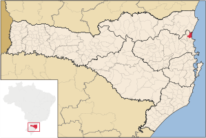
Location of the municipality of Barra Velha in the state of Santa Catarina
|
|
| Basic data | |
| Country | Brazil |
| Federal District |
|
| City foundation | 1961 |
| Residents | 22,386 (IBGE / 2010) |
| City insignia | |
| Detailed data | |
| surface | 139.153 km² |
| Population density | 159.78 inhabitants / km 2 |
| height | 35 m |
| Time zone | UTC −3 |
| Website | |
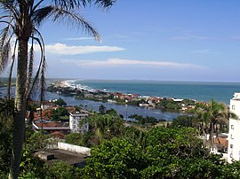
| View from Morro do Cristo | |
Barra Velha is a small town with around 28,463 inhabitants (2018) in the state of Santa Catarina in southern Brazil . Tourism can temporarily increase the population to up to 200,000.
The city lies along the red-sand coast of Santa Catarina and is easily passable by the BR-101 road. Due to its location, it offers very good conditions for water tourism in the offshore lagoon. Fishing and agriculture , as well as livestock and dairy farming, are predominant here .
Web links
Commons : Barra Velha - collection of images, videos and audio files
- IBGE to Barra Velha. Retrieved June 18, 2019 (Brazilian Portuguese).
- Official website of Barra Velha. Retrieved June 18, 2019 (Brazilian Portuguese).
- Barra Velha tourism website. Retrieved June 18, 2019 (Brazilian Portuguese).


