Barren Island (Andaman Islands)
| Barren Island | |
|---|---|
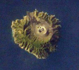
| NASA image of the volcanic island | |
| Waters | Indian Ocean |
| Archipelago | Andaman Islands |
| Geographical location | 12 ° 16 '30 " N , 93 ° 51' 30" E |
| length | 3.5 km |
| width | 2.9 km |
| surface | 8 km² |
| Highest elevation | 354 m |
| Residents | uninhabited |
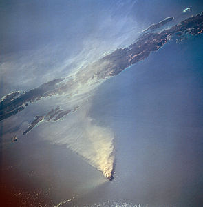
| The 1995 eruption | |
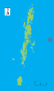
Barren Island is a small volcanic island in the Indian Ocean that belongs to the Andaman archipelago and is located about 100 km east of the main islands. It has a diameter of around 4 km, an area of around 8 km² and reaches a height of 354 m above sea level. Barren Island is uninhabited and politically belongs to the Indian Andaman and Nicobar Union Territory .
The stratovolcano- type volcano located on the island is comparatively active. An eruption was registered as early as May 12, 1787, which could be seen as far as Port Blair , the capital of the Andaman Islands. Further eruptions took place on March 24, 1789 (explosive eruption), December 20, 1795, November 1803 to January 1804, March 1832, March 29 to October 1991 (discharge of 2.6 million cubic meters of lava and 5.2 million cubic meters Ash), December 1994 to June 1995 (discharge of 2.3 million cubic meters of lava and ash each), from May 26, 2005 to December 2007 and most recently since May 13, 2008 (explosive eruptions and lava flows). Calculated from the sea floor, the volcano rises to a height of 2250 m, the caldera measures about 2 km in diameter.
Another volcano of the archipelago is located 150 km northeast of Barren Island on Narkondam .
Web links
- Barren Iceland in the Global Volcanism Program of the Smithsonian Institution (English)
- Article of the Geological Survey of India on the 2011 eruption (PDF, English; 276 kB)
- BBC article about the outbreak in 2005 (English)


