Bear Cove Ferry Terminal
| Bear Cove Ferry Terminal | |||
|---|---|---|---|
| Data | |||
| Port type | Sea port / ferry port | ||
| Piers / quays | 1 | ||
| Geographic information | |||
| place | Port Hardy | ||
| province | British Columbia | ||
| Country | Canada | ||
| Bear Cove Terminal as seen from the sea | |||
| Coordinates | 50 ° 43 '32 " N , 127 ° 27' 22" W | ||
|
|||
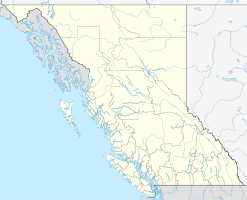
The Bear Cove Ferry Terminal is a ferry port on Vancouver Iceland in the Canadian province of British Columbia . It is located on Queen Charlotte Strait , near the town of Port Hardy in the Regional District of Mount Waddington . The tidal range of Queen Charlotte Strait is usually between 2 and 6 meters. The ferry port forms the northern end of Highway 19 , among other things .
BC Ferries ( British Columbia Ferry Services Inc. ), as the main operator of the ferry connections on the west coast of British Columbia , operates various routes from here.
Routes
From here the following goals are approached:
- Inside Passage to Prince Rupert , with stops in Bella Bella and Klemtu
- Discovery Coast Passage to Bella Coola , with stops in Bella Bella, Shearwater, Klemtu and Ocean Falls
However, the Discovery Coast Passage is only served in the summer months. During the winter months, these ports are called alternately as part of the Inside Passage.
See also
Web links
Individual evidence
- ↑ Port Hardy (# 8408) Tidal Prediction. Fisheries and Oceans Canada , accessed April 29, 2016 .

