Beauchene Island
| Beauchene Island | ||
|---|---|---|
| Seal hunters with killers in seal colony on Beauchene Island (1833) | ||
| Waters | South Atlantic | |
| Archipelago | Falkland Islands | |
| Geographical location | 52 ° 53 ′ 11 ″ S , 59 ° 12 ′ 13 ″ W | |
|
|
||
| length | 3.3 km | |
| width | 650 m | |
| surface | 1.72 km² | |
| Highest elevation | 70 m | |
| Residents | uninhabited | |
|
Map from 1744 with Beauchene Island (far too far west) |
||
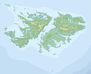
Beauchene Island (Spanish: Isla Beauchêne ) is the southernmost of the Falkland Islands . It is located about 70 km south of Sea Lion Island , is uninhabited and a nature reserve . The remote island was discovered in 1701 by the French Jacques Gouin de Beauchêne .
The 172 hectare island consists of a southern part with the highest elevation of 70 meters, and a northeast part with bare and steep rocks. Both parts are connected by a sandy isthmus.
The island is known for its cave-rich coast. Black- browed albatross , rockhopper penguins (4000 specimens) and sea lions (6000 specimens) live here in large colonies . A special feature of the island is the rich deposits of peat , which, for reasons that have not yet been clarified, develops up to 10 times faster than elsewhere.
There is a natural anchorage to the east of Beauchene Island, but it can only be used in calm weather.
There are building ruins on the west side. The island was inhabited from 1834 to 1837. In 1834 the American McArther landed on the island with 100 settlers. Two years later, there were hardly any sea lions left. The settlement was abandoned because of the difficult access.
See also
Individual evidence
- ↑ Description Beauchenne Island, PDF ( Memento from April 10, 2011 in the Internet Archive )
- ↑ a b Wolfgang Schippke Beauchene Island ( memento from September 27, 2011 in the Internet Archive ), accessed on August 8, 2016


