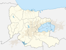
Belén (Venezuela)
| Belén | ||
|---|---|---|
|
Coordinates: 9 ° 59 ′ N , 67 ° 41 ′ W Belén on the map of Carabobo
|
||
| Basic data | ||
| Country | Venezuela | |
| State | Carabobo | |
| City foundation | 1873 | |
| Residents | 15,000 (range 2006) | |
| Detailed data | ||
| Post Code | 2034 | |
| Time zone | UTC -4.5 | |
Belén is a Venezuelan village south of Lake Valencia , in the municipality of Carlos Arvelo in the state of Carabobo .
economy
The inhabitants live mainly from agriculture.
