Carabobo
| Carabobo | ||
|---|---|---|
| Symbols | ||
|
||
| Basic data | ||
| Country | Venezuela | |
| Capital | Valencia | |
| surface | 4650 km² | |
| Residents | 2,494,800 (2017 estimate) | |
| density | 537 inhabitants per km² | |
| ISO 3166-2 | VE-G | |
| Website | www.carabobo.gob.ve (Spanish) | |
| politics | ||
| governor | Henrique Salas Feo | |
| Political party | Proyecto Venezuela | |
Coordinates: 10 ° 7 ′ N , 68 ° 3 ′ W
Carabobo is one of the smallest, but at the same time most populous federal states in Venezuela . The area of Carabobo accounts for 0.51% of the area of Venezuela, but the state has about nine percent of the total population of the country. The capital is Valencia .
Before the arrival of the Europeans, this region around Lake Valencia was one of the most important cultural centers in the area that later became Venezuela. The Battle of Carabobo took place on its territory , as well as other important battles in the War of Independence in the 19th century .
The state has many of Venezuela's major industries as well as the country's largest port, Puerto Cabello .
geography
Carabobo is part of the Central region and borders the states of Falcón in the northwest, Yaracuy in the west, Cojedes and Guárico in the south, Aragua in the east and the Caribbean in the north . With its north, west and south banks, Lake Valencia belongs to Carabobo.
Administrative division
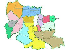
The state of Carabobo is divided into the following districts ( Municipios ):
| district | Seat of government | Population 2011 | Area km² |
Population density |
|---|---|---|---|---|
| Bejuma | Bejuma | 46,041 | 469 | 98.17 |
| Carlos Arvelo | Güigüe | 149.313 | 835 | 178.82 |
| Diego Ibarra | Mariara | 111,938 | 79 | 1416.94 |
| Guacara | Guacara | 174,868 | 165 | 1059.81 |
| Juan José Mora | Morón | 66,269 | 453 | 146.29 |
| Libertador | Tocuyito | 178.904 | 558 | 320.62 |
| Los guayos | Los guayos | 161,341 | 73 | 2210.15 |
| Miranda | Miranda | 28,135 | 161 | 174.75 |
| Montalbán | Montalbán | 24,154 | 107 | 225.74 |
| Naguanagua | Naguanagua | 144.308 | 188 | 767.70 |
| Puerto Cabello | Puerto Cabello | 196.942 | 729 | 270.15 |
| San Diego | San Diego | 77,154 | 106 | 727.87 |
| San Joaquín | San Joaquín | 62,777 | 127 | 494.31 |
| Valencia | Valencia | 839.926 | 623 | 1348.20 |
The districts in turn have one or more parroquias ( parishes ). Carabobo has a total of 38 parroquias.
| district | Parroquias |
|---|---|
| Bejuma | Bejuma, Canoabo, Simón Bolívar |
| Carlos Arvelo | Güigüe, Belén, Tacarigua |
| Diego Ibarra | Aguas Calientes, Mariara |
| Guacara | Guacara, Yagua, Ciudad Alianza |
| Juan José Mora | Morón, Urama |
| Libertador | Tocuyito, Independencia |
| Los guayos | Los guayos |
| Miranda | Miranda |
| Montalbán | Montalbán |
| Naguanagua | Naguanagua |
| Puerto Cabello | Bartolomé Salón, Democracia, Fraternidad, Goaigoaza, Juan José Flores, Unión, Borburata, Patanemo |
| San Diego | San Diego |
| San Joaquín | San Joaquín |
| Valencia | Candelaria, Catedral, El Socorro, Miguel Peña , Rafael Urdaneta, San Blas, San José, Santa Rosa, Negro Primero |
The conversion of the parroquia Miguel Peña , with over 500,000 inhabitants, into a district has been discussed for a long time .
Cities
- Valencia : Capital of the state and third largest city in Venezuela.
- Puerto Cabello : Venezuela's largest port.
- Guacara : Headquarters of the Guacara district, northeast of Valencia.
- Morón : town in the northwest on the road between Puerto Cabello and Coro.
- Los Guayos : Headquarters of the Los Guayos district, east of Valencia, formerly an Indian village.
- Miranda
- San Diego : Small town, headquarters of the district of San Diego, founded by Indians.
- Tocuyito : city southwest of Valencia, on the way to the plains.
- Güigüe : Headquarters of the Carlos Arvelo district.
- Yagua : Small town in the Guacara district, used to be an Indian settlement.
- Canoabo : City between the mountains in the western part of Carabobo.
nature and landscape
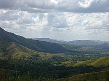
The coastal mountains extend to the north and west. To the east is Lake Valencia or Tacarigua, the largest inland lake in Venezuela. In the center and in the south there are plains and in the south-east south of Lake Valencia there are again mountains.
Carabobo has three catchment areas: the Caribbean, Lake Valencia and the South.
Waters
Caribbean catchment area
The rivers here include:
- Aguas Calientes
- Borburata
- Goaigoaza
- Morón
- Patanemo
- Sanchón
- San Esteban
- Urama
These rivers form in the coastal mountains and flow into the Caribbean.
The catchment area of Lake Valencia
The following rivers are worth mentioning here:
All of these rivers flowed into Lake Valencia, although the Cabriales is now being diverted to the Paíto.
Lake Valencia or Lake Tacarigua is the second largest inland lake in South America after Lake Titicaca .
Southern catchment area
The main rivers here are the Pao River and the Manaure River. They flow into the Guárico and Portuguesa rivers, which are part of the Orinoco Basin.
Flora and fauna

Although the state is densely populated, there are large areas where nature has been very well preserved. These include a. the San Sebastian National Park, the mountain regions in the southeast of the state and many mountain areas in the western, especially in the communities of Bejuma and Montalbán.
Carabobo has predominantly tropical vegetation. Mangroves such as the red mangrove and Coccoloba uvifera grow on the coast .
Typical animal species in the state include:
- Birds: Pfäffchen , Carduelis psaltria , various hummingbird species , red-tailed guuan , silver- billed tangerine
- Reptiles: Green iguanas , common lance vipers , Venezuelan lance vipers , idol snakes , pointed crocodiles on the coast
- Mammals: umbilical pigs , Central American agouti , red deer , southern opossums , pumas
environmental issues
The very rapid population growth of the past 100 years has also accelerated the damage to the local environment. Lake Valencia and several rivers are already showing significant environmental pollution. Black waters are discharged into these waters and the Caribbean without being cleaned up . There are also numerous landfills that do not meet international standards.
Parks
- The San Esteban National Park is 43,500 hectares and is located in the northeast of the state. It borders the Parque Nacional Henri Pittier . The San Esteban has a diverse landscape, fauna and flora. There are islands and beaches, as well as mountains that reach 1,800 meters above sea level.
- The Parque Municipal Cerro Casupo (Mountain Casupo Municipal Park) is 693 hectares and is located west of Valencia . It is considered one of the lungs of Valencia. The height of the park varies from 450 to 980 meters above sea level.
history
prehistory
First tracks
The most important cultural center of the native Americans in the center of what is now Venezuela was around Lake Valencia . The ethnic groups of the region were hunters, gatherers, but also fishermen and farmers. Many petroglyphs and pottery remains from this period still survive.
In the region that now forms Valencia, the presence of humans has been recorded since the fourth millennium BC. In other regions of Carabobo (such as Bejuma ), archaeological findings have been discovered that indicate an even older human presence.
Archaeologists have found that important settlement around the lake took place between AD 200 and 1000. The inhabitants were already farming.
Second wave
At the end of the first millennium, Orinoco peoples arrived , probably across the El Pao River. From the eighth century onwards, the Orinoco peoples began to mingle with the settlements around Lake Valencia. This amalgamation formed the cultura valencioide or Valentia culture . The people built their houses on artificial hills in the fertile valleys west and east of Lake Valencia. They mainly made anthropomorphic sculptures.
Around the year 1200 , the Valencian culture reached the entire region around the Basin of Lake Valencia, the center of the north coast of Venezuela and various small islands in the Caribbean. From the islands in the Lake Valencia area, sea products such as large fenced snails , salt (mainly from the Araya Peninsula), turtles and fish from coral reefs were imported. The trade took place through coastal villages.
Taramainas, Tacariguas and other tribes inhabited the area around Lake Valencia when the Europeans arrived. The tribes that inhabited the Carabobo region were predominantly members of the Arawak language family , but also Caribs .
The Indians of the region grew corn , a typical product of western cultures in South America, and cassava , a plant that was cultivated more by eastern Indians. From that time, many metates or stones for grinding mail and budares for preparing kasavah from cassava have been preserved.
The Jirajara , from the region of Nirgua (now the border between Carabobo and Yaracuy ), went east to Lake Valencia and thence through the mountains to Borburata on the coast to get salt.
Spanish conquest and colony
Alonso de Ojeda and his people were very likely the first Europeans to see this region when they drove west along the coast in August 1499.
Villegas founded the village of Borburata in 1548. He also founded Valencia in 1555. During that time, more and more Spaniards settled in the region. The Indians were driven from many areas or distributed in encomiendas , where they had to work for the immigrants. Many attacks by French and English pirates took place in the 16th and 17th centuries. One of the first actions by these pirates took place in 1555 when the French attacked Borburata for six days.
British pirates, led by John Hawkins, forced the settlers of Borburata to trade goods in 1564.
The pirate Lowell attacked Borburata again in 1566. French pirates, led by Nicolas Vallier, occupied Borburata in 1567.
John Hawkins forced the settlers of Borburata to trade goods with him again in 1568. These attacks resulted in the village being abandoned for years. The settlers went mainly to Valencia.
In 1569 Pedro de Malaver arrived in Borburata with over 500 settlers. He wanted to find a Dorado and found Nueva Extremadura. Between Borburata and Valencia, however, most of the settlers left him and most of them stayed in the region.
In 1577 and 1583, the region of Valencia was attacked by various Caribbean tribes from the Lower Orinoco. Spanish troops led by Garci-González repulsed them.
In 1677, Valencia was sacked again by French pirates and almost all of the city's documents were destroyed.
The Guipuzcoana company from the Basque Country got the trade monopoly for the province of Venezuela in the 18th century. In 1730 the company set up the port of Puerto Cabello .
In 1800 Alexander von Humboldt visited the region on his trip through South America. He wrote extensively about the nature and society of the area.
War of Independence
On April 19, 1810, Venezuela's independence was declared in the Casa de la Estrella in Valencia. On July 5th, the declaration of independence was signed in the same place.
From that moment on, a war began that would last over ten years. In 1812, Francisco de Miranda and Simón Bolívar fought several important battles in the region. In the following years, Valencia was occasionally occupied by royalists and independence fighters.
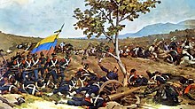
On June 24, 1821, the Battle of Carabobo took place. It was one of the most important battles on the way to Venezuela's independence.
Even if other battles followed until 1823, independence was considered relatively secure.
The Spanish troops, which remained in the fortress of San Felipe in Puerto Cabello, left Venezuela on November 10, 1823.
On June 24, 1824, the Province of Carabobo was founded from part of the Province of Caracas.
Valencia became Venezuela's first capital when it separated from Greater Colombia.
The young republic
The Monagas family, who held leading positions in the War of Independence, had amassed land holdings for years. This led to protests in 1858 that marked the end of José Tadeo Monagas' government. In the following months there were many uprisings by poor people in Carabobo and other regions of Venezuela, who felt disappointed against the new rulers because they believed that they had betrayed the ideals of the uprising (including distributing land).
On December 31, 1858, the constitutional assembly took place in Valencia. Then the constitution of 1858 was passed, which led to certain concessions for the poor: the right to vote for all men was introduced and slavery was forbidden.
20th century
In 1917 and then in 1933, the Venezuelan government made several border changes between the states of Aragua and Carabobo, with Carabobo losing territories to Aragua.
During the reign of Juan Vicente Gómez (and until his death in 1935) large parts of the region were in the hands of friends of the President.
On March 31, 1941, the crew of several Italian and German ships that were in Puerto Cabello decided to destroy their ships. They thought the Americans would hog the ships. They exploded the ships and there was a big fire in the harbor. Several hundreds of them were detained in Carabobo. However, many of the Italians were released shortly afterwards and have since settled in Venezuela. The German ship had to be towed to an island off Puerto Cabello.
At the end of the Second World War, massive immigration from Europe to Venezuela began. First came many Germans and Eastern Europeans. Carabobo was one of the main targets. On September 2, 1947, the first contingent "A" of immigrants from Germany arrived in Puerto Cabello. Then came u. a. many Ukrainians, Poles and Balts. Later the immigrants were mainly Spaniards and Italians.
In the 1970s, more immigrants came from other South American countries.
Valencia began to develop into an industrial city in the middle of the twentieth century. Many industries emerged, especially in the south of the city and west of it towards Lake Valencia.
In 1989 the first regional elections took place in Venezuela and so the people could for the first time directly elect their governors and mayors. Henrique Salas Roman became Carabobo's first governor.
21st century
In 2004, Luis Felipe Acosta Carlez, a military man who supported Hugo Chávez , became governor of Carabobo. The state has been grappling with a rapid increase in crime in recent years, particularly in the slums. Many poor people from the region, but also from other regions of Venezuela and Latin America, have come to Carabobo in recent years. Land occupations emerged in many areas, where hundreds of people occupied private or public land and built slums. This is the case southeast of Valencia, around Naguanagua, north of San Diego and other areas. This has become a political issue.
The two blocks of reform proposals that Hugo Chávez had submitted for the constitution were rejected in Carabobo on December 2, 2007 by 52.82% and 53.12% of the electorate (50.70% and 51.05% nationally) .
Attractions
- Bolivar Square and Valencia Cathedral .
- Aquarium Valencia or Acuario de Valencia (the largest aquarium in Latin America and a small zoo)
- Negra Hipólita Park in Valencia: this is a large park with many facilities for both children and adults.
- Aguas termales de las Trincheras: thermal baths, visited and described by Humboldt.
- Old town of Puerto Cabello
- Spanish fortress of Puerto Cabello
- Spanish fortress Solano (also near Puerto Cabello)
- Patanemo beach on the coast
- Mountains and coast in the San Esteban National Park
- Native American petroglyphs in Vigirima
- Canoabo Mountains in the west of the state
- Campo Carabobo, southwest of Valencia: Memorial to a decisive battle in Venezuela's war of independence
- Abbey of San José , in Güigüe , founded by German monks.
- Colonial Church of Los Guayos
- San Diego Colonial Church
Colonial Church of Los Guayos
Solano Fortress in Puerto Cabello
Patanemostrand or Playa de Patanemo, east of Puerto Cabello
economy
Carabobo has the most important industries in Venezuela. Agriculture also plays an important role.
On the coast, near Morón , is one of the largest petrochemical centers in Latin America, Complejo El Palito.
education
Universities
The largest University of Carabobo and one of the most important in Venezuela is the Universidad de Carabobo , which has around 40,000 students.
There are also a number of other private universities and colleges, such as:
- Universidad José Antonio Páez.
- Universidad Tecnológica del Centro.
- Arturo Michelena University
- Colegio Universitario Padre Isaías Ojeda (CUPIO)
- Universidad Nacional Experimental Politécnica de la Fuerza Armada (Núcleos en Valencia y Puerto Cabello).
- Universidad Nacional Experimental Simón Rodríguez (Decanato Valencia y Nucleo Canoabo)
- Instituto Universitario de Tecnología Valencia
- Universidad Santiago Mariño
- Universidad Alejandro Humboldt
Science and technology
Among the most important research centers are the FUNDACITE (Foundation for the Development of Technology in Carabobo) and the Universidad de Carabobo, especially the Faculty of Science and Technology.
Culture
gastronomy

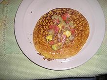
The cuisine in Carabobo shares many components with other regions of Venezuela: Cachapas , Arepas , Hallacas . In addition, there are some specialties of the region such as:
- Chicha made from corn
- Fried fish with tostones (fried plantains ), rice and salad, mainly on the coast
- Orange and lemon cake
- The panelas de San Joaquín from San Joaquín : a kind of aniseed cake
media
The main newspapers are El Carabobeño and Notitarde.
Sports
One of the largest sports centers is the Polideportivo Misael Delgado in Valencia. There is also a "Valencia Olympic Villa" between Valencia and Naguanagua .
baseball
One of the most important baseball teams in Venezuela are the Navegantes del Magallanes , headquartered in the José Bernardo Pérez Stadium.
basketball
Trotamundos de Carabobo is one of the most successful teams in Venezuela.
Soccer
The Carabobo Fútbol Club is located in the Polideportivo Misael Delgado.
To go biking
The Velódromo Máximo Romero is the seat of the Asociación Carabobeña de Ciclismo.
traffic
Roads and motorway network
Carabobo has one of the best road networks in Venezuela. The main routes are:
- Caracas-Valencia motorway that runs from Valencia north of Lake Valencia to Caracas.
- Bárbula-Puerto Cabello motorway that goes from Northern Valencia to the coast and then to San Felipe (A-1).
- Valencia-Campo Carabobo motorway that turns into the N-5, connecting Valencia to Tinaquillo and thus to the west.
- Road 3, which runs from Puerto Cabello to Coro via Morón.
- The 11 that goes from Valencia southeast towards Güigüe and from there to Villa de Cura, in Aragua.
- The 4 that runs between Urama and Bejuma.
Buses from other regions mainly arrive at the Big Low Center in San Diego. From there there are numerous buses that go to Valencia and other cities in the region.
air traffic
Carabobo's airports are Arturo Michelena International Airport, east of Valencia, and Bartolomé Salom International Airport, in Puerto Cabello .
Trains and subway
There is currently a low-traffic train line between Barquisimeto and Puerto Cabello . A railway line is now being built between Valencia and Caracas.
Valencia has a metro. Six stops were in operation at the beginning of 2008, but the subway will connect the entire city from south to north in the following years.
seafaring
One of the most important ports in Venezuela is in Carabobo: the port of Puerto Cabello . Lake Valencia now only has boats for private use.
Carabobo's sons and daughters
- Antonio Herrera Toro , painter
- Arturo Michelena , painter.
- Eugenio Montejo , poet (born in Caracas, but mainly based in Valencia)
- Luis Pérez Carreño , doctor, founder of the Clinic for Poor Children
- Vicente Gerbasi , poet
credentials
- ↑ Carabobo (Venezuela): Municipalities & Urban Places - Population Statistics, Graphics and Map. Retrieved April 15, 2018 .
- ↑ Estimates from INE ( page no longer available , search in web archives ) Info: The link was automatically marked as defective. Please check the link according to the instructions and then remove this notice.
- ↑ Environmental report of the Faculty of Engineering at the Universidad de Carabobo ( Memento of the original from October 3, 2008 in the Internet Archive ) Info: The archive link has been inserted automatically and has not yet been checked. Please check the original and archive link according to the instructions and then remove this notice.
- ^ Instituto Nacional de Parques - Home
- ↑ Historia de Valencia ( Memento of the original from April 6, 2008 in the Internet Archive ) Info: The archive link was inserted automatically and has not yet been checked. Please check the original and archive link according to the instructions and then remove this notice.
- ↑ Historia precolombina en Notitarde ( Memento of the original of July 12, 2008 in the Internet Archive ) Info: The archive link has been inserted automatically and has not yet been checked. Please check the original and archive link according to the instructions and then remove this notice.
- ↑ Cultura valencioide, Andrzej Antczak and Ma. Magdalena Mackowiak de Antczak ( Memento of the original from June 17, 2008 in the Internet Archive ) Info: The archive link was inserted automatically and has not yet been checked. Please check the original and archive link according to the instructions and then remove this notice.
- ↑ Archive link ( Memento of the original from October 3, 2008 in the Internet Archive ) Info: The archive link was inserted automatically and has not yet been checked. Please check the original and archive link according to the instructions and then remove this notice. Interethnic Relations of the Indians of Venezuela (in Spanish)
- ^ [1] Humboldt in Venezuela
- ↑ Archive link ( Memento of the original dated December 6, 2008 in the Internet Archive ) Info: The archive link was inserted automatically and has not yet been checked. Please check the original and archive link according to the instructions and then remove this notice. in English
- ^ Constitutional referendum in Carabobo
- ↑ Fundacite en Carabobo ( Memento of the original from April 17, 2006 in the Internet Archive ) Info: The archive link has been inserted automatically and has not yet been checked. Please check the original and archive link according to the instructions and then remove this notice.
- ↑ Archived copy ( Memento of the original from July 3, 2008 in the Internet Archive ) Info: The archive link was inserted automatically and has not yet been checked. Please check the original and archive link according to the instructions and then remove this notice. Facultad de Ciencias y Tecnología
bibliography
- Manzo Nuñez Torcuato (1981) Historia del Estado Carabobo . Ediciones de la Presidencia de la República. Caracas.
- Alexander von Humboldt: Journey to the equinoctial regions of the new continent. Volume 2.


