
Guárico
| Guárico | |||
|---|---|---|---|
 .svg) |
|||
| Symbols | |||
|
|||
| Basic data | |||
| Country | Venezuela | ||
| Capital | San Juan de los Morros | ||
| surface | 64,986 km² | ||
| Residents | 905,000 (2017) | ||
| density | 14 inhabitants per km² | ||
| ISO 3166-2 | VE-J | ||
| Website | www.guarico.com.ve (Spanish) | ||
| politics | |||
| governor | Luis Enrique Gallardo | ||
| Political party | United Socialist Party of Venezuela | ||


Coordinates: 8 ° 45 ′ N , 66 ° 14 ′ W
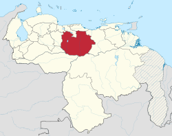
Guárico is one of the 23 states of Venezuela . The capital is San Juan de los Morros . Guárico is bordered to the north by the states of Carabobo , Aragua and Miranda , to the south by Apure and Bolívar , to the west by Cojedes and Barinas and to the east by Anzoátegui .
In the north, Guárico consists of a mountainous border, the rest is dominated by the Llanos , through which the Orinoco also flows. The name is derived from the river of the same name , which means something like cacique (chief) in a Caribbean language .
physical geography

Guárico is part of the Venezuelan Llanos . The state is about the size of Latvia and slightly smaller than Bavaria.
geology
For the most part, Guárico is very flat. To the north are mountains like Los Morros and part of the coastal mountain range.
Main mountains in Guárico:
- Pico Platillón (1929 m)
- Cerro La Gloria (1570 m)
- Pico Blanco (1500 m)
- Topo Valentinero (1430 m)
- Topo Cujicito (1410 m)
- Cerro Caramacate (1290 m)
- Cerro Platanal (1250 m)
- Topo Paraparo (1210 m)
- Cerro Aserradero (1130 m)
- Morros de San Juan (1068 m)
Waters
The rivers of the Unare Basin flow from the valley of Valle de la Pascua to the Caribbean in a north-easterly direction: Unare, Quebrada Honda, Morichito, Santa María de Ipire and Agua Amarilla. The other rivers in the state tend to flow from north to south towards the Orinoco. Important rivers Guáricos are Río Chirgua, Río Espino, Río Guárico , Río Macaira, Río Manapire, Río Memo, Río Tamanaco, Río Tiznados, Río Tucupido, Río Orituco and Río Zuata.
nature
flora

The Guáricos plants are typical of the South American Llanos. The Copernicia tectorum is a species of palm that is very common in Guárico and a symbol of the state. The buriti palm is also very common.
fauna
Many species of fish can be found here, such as the black pacu , the pavón, the electric eel , various types of serrasalmus, surubim and others. a.
Among the mammals of the region one can find
- the Capibara (Hydrochoerus hydrochaeris)
- Howler monkey (Alouatta palliata)
- great anteater (Myrmecophaga tridactyla)
- Armadillos (Dasypoda)
- Giant armadillos (Priodontes maximus)
- White-tailed deer (Odocoileus virginianus)
- Jaguars (Panthera onca)
- Pumas (Felis concolor)
- Cunaguaros (Leopardus tigrinus)
The Amazon dolphins also live in the larger rivers. Giant otters can also be found there.
natural reserve
- Aguaro-Guariquito National Park
history
Pre-Columbian times
People lived in this region as early as 3500 BC. BC archaeologists primarily distinguish three cultural areas:
- the Unare region in the northeast
- the region of mountains and hills in the north-northwest
- the southern region or real Llanos
Before the arrival of the Spaniards, numerous Indian ethnic groups lived in this region: Cumanagotos and Palenkes (who were Caribs ), Otomaks , Guamos and others.
Ur-Americans like the Otomaks and Guamos lived primarily as hunters and gatherers. Agriculture tended to be practiced in the northern area.
Conquest and Colonial Era
The Spaniards began to colonize the region around Los Morros in the north at the end of the sixteenth century. Many Spaniards came to the northern area of Guáricos because the Caracas and Tuy valleys were already occupied by other new settlers and they were still in search of gold and encomiendas . Most of the Spanish villages were not founded by Catholic missionaries until after 1660 and especially in the eighteenth century. They came to take control of the region only in the seventeenth century.
Spanish settlers founded El Sombrero in 1720. Four years later they founded Calabozo . In 1728 the Spaniards founded the village of Chaguaramas in a place where Cumanagoto Indians had previously lived. The monk Anselmo Isidro de Ardales established the village of Tucupido in 1760 with groups of Cumanagotos.
Altagracia de Orituco was founded in 1769. San Juan de los Morros was not officially founded until 1780.
Guárico was part of the province of Caracas during colonial times.
Alexander von Humboldt crossed the Llanos through Guárico at the beginning of 1800 and carried out many scientific studies in the region. At that time he described how native Americans were still organized in missions of the Catholic monks and how many robbers and refugee slaves sought refuge in the region. The region was particularly suitable for raising cattle. The cultivation of useful plants was hardly practiced, because in the summer time many regions were very dry and there were no irrigation systems.
Nineteenth century


War of Independence
Several important battles of the War of Independence took place in Guárico.
The military leader José Tomás Boves struck down the liberation fighter Campo Elías on February 3, 1814 in La Puerta, San Juan de los Morros. A few months later, in June, troops loyal to Spain, led by Boves, fought again against the Liberation Army in this area, this time led by Simón Bolívar and Mariño. Boves managed to defeat the Liberation Army a second time.
On August 2, 1816, the Quebrada-Honda battle took place near El Socorro . The royalists were defeated by the Independence Army under the leadership of the adventurer and impostor Gregor MacGregor .
On February 12, 1818, the independence troops led by José Antonio Páez defeated the troops of the Spanish officer Pablo Morillo . Shortly afterwards, however, on March 16, 1818, Pablo Morillo was able to put down Simón Bolívar's troops in La Puerta, near San Juan de los Morros.
Caudillo period
After independence, Guárico was repeatedly a battlefield in the country's various civil wars.
Venezuela was hit by a serious economic crisis from 1842 onwards. In 1846 there was a peasant uprising, which became particularly important in the Llanos and thus in Guárico. The insurgents complained about the social injustice and the political grievances. The protests continued until May 1847.
In 1848 the province of Caracas was divided into three smaller provinces; Guárico was one of them.

On February 17, 1860, the Battle of Coplé between the federalists and troops of the central government took place near Calabozo . The battle itself was not decisive for the government or the rebels. The continuation of the guerrilla war, however, contributed to the fact that the government, led by Guzmán Blanco, signed a peace agreement with the federalists on March 23, 1863.
On March 11, 1892, the military and landowner Joaquín Crespo rose against the then president, Raimundo Andueza Palacio, who had changed the constitution to rule for two years after his reign in early 1892. Joaquín Crespo marched from his hacienda in Guárico against Caracas.
From the twentieth century to the present
Juan Vicente Gómez defeated in a short battle near San Juan de los Morros the troops of General Luciano Mendoza, who fought on the side of the so-called Revolución Liberadora against Cipriano Castro .
Since 1946, foreign companies have been finding oil in the state of Guárico. The fields around El Carrizal and then El Sombrero attracted many workers. The oil companies built a road from El Sombrero to Puerto La Cruz and invested in hospitals and schools. At the end of 1947, however, it was decided that Carrizales was not economical. So the oil companies moved away from this village, and with them the money. El Sombrero and other regions of Guárico continued to produce oil.
In 1957, the construction of the Guárico reservoir began. With 230 km 2 it is the largest reservoir in Venezuela and contributes significantly to the region's agriculture.
In 1988, as everywhere in Venezuela, the first direct elections for the governor took place.
politics
The current governor is Luis Enrique Gallardo of the PSUV . The state sends five MPs to the National Assembly . For the period 2011–2016 there are three MPs from the PSUV, one from the PCV and one independent, supported by the Democratic Unity Group.
2008 gubernatorial elections
The 2008 elections resulted in the following distribution of votes:
- William Lara: 52.54%, supported by
PSUV PCV UPC
- Lenny Manuitt: 33.20%, supported by
PPT MIRAG GE UNIDOS et al
- Reinaldo Armas: 13.42%, supported by
AD GEMORO UNTC Proyecto Venezuela et al
economy
The region's economy is predominantly agricultural. Corn, rice and sorghum are grown here. There is a notable breeding of cattle and pigs .
Silica sand , barite , gypsum, gravel and zinc are mined in Guárico.
Petroleum industry
Guárico is located in the so-called Orinoco Belt, an area north of the Orinocos where there are large reserves of petroleum. The petroleum can mainly be extracted in the form of oil sands, which brings great difficulties for production and processing.
PDVSA has been trying to reactivate oil fields in West Guárico since 2010.
Administrative division

(1) José Tadeo Monagas , (2) San José de Guaribe , (3) Chaguaramas ,
(4) José Félix Ribas , (5) Zaraza , (6) Leonardo Infante ,
(7) El Socorro , (8) Santa María de Ipire , (9) Las Mercedes ,
(10) Guayabal , (11) Camaguán , (12) Miranda ,
(13) Ortiz , (14) Roscio , (15) Mellado
The state is made up of 15 districts ( Municipios ):
| Municipio | Capital | Residents 2011 | Area in km² |
|---|---|---|---|
| Camaguan | Camaguan | 24,391 | 1,164 |
| Chaguaramas | Chaguaramas | 12,966 | 2,069 |
| El Socorro | El Socorro | 17.097 | 1,164 |
| Francisco de Miranda | Calabozo | 141,987 | 13,490 |
| José Félix Ribas | Tucupido | 38,408 | 2,792 |
| José Tadeo Monagas | Altagracia de Orituco | 74,559 | 3,455 |
| Juan Germán Roscio | San Juan de los Morros | 126.178 | 1,824 |
| Julián Mellado | El Sombrero | 27,664 | 2.983 |
| Las Mercedes | Las Mercedes | 33,025 | 7,691 |
| Leonardo Infante | Valle de la Pascua | 120,889 | 10,613 |
| Ortiz | Ortiz | 23,755 | 4.129 |
| Pedro Zaraza | Zaraza | 62,027 | 2,410 |
| San Gerónimo de Guayabal | Guayabal | 20.206 | 4,357 |
| San Jose de Guaribe | San Jose de Guaribe | 11,426 | 1,128 |
| Santa Maria de Ipire | Santa Maria de Ipire | 13,161 | 4,549 |
Most important cities
| Cities of Guáricos | ||||
|---|---|---|---|---|
| city | population | Municipio | ||
| 1981 census | 1990 census | 2008 estimate | ||
| Calabozo | 61,995 | 89.402 | 148,298 | Francisco de Miranda |
| San Juan de los Morros | 70,916 | 81,028 | 125,876 | Juan Germán Roscio |
| Valle de la Pascua | 59,582 | 86,881 | 124,468 | Leonardo Infante |
| Zaraza | 15,480 | 30.181 | 51,777 | Pedro Zaraza |
Education and culture
The following universities and colleges are located in Guárico:
- Universidad Nacional Experimental de los Llanos Centrales Rómulo Gallegos
- Universidad Nacional Abierta
- Universidad Nacional Experimental Politécnica de la Fuerza Armada Nacional
- Universidad Nacional Experimental Simon Rodríguez
- Pedagógica Experimental Libertador
- Universidad Bolivariana de Venezuela
- Instituto Nacional Cooperación Educativa
- Instituto Universitario Monseñor Arias Blanco
- Instituto Universitario de Tecnología de los Llanos
- Colegio Universitario de Administración y Mercadeo
kitchen
The most famous dish is the "Pisillo Guariqueño". It is fried venison with garlic and paprika that has been dried under the sun. You also eat a lot of beef, river fish and capibara meat .
The chicken soup is also very popular in the region.
Attractions
The Morros

Alexander von Humboldt describes it as follows:
- “These crests form steep peaks that rise on a rock wall with a very broad base. The wall drops off steeply and resembles the devil's wall ... These peaks can be seen in the Llanos from a great distance, they make a strong impression on the imagination of the inhabitants of the plains, who are not used to any unevenness of the ground. " )
San Juan de Los Morros thermal baths
The place has bathing halls and swimming pools and is located northwest of San Juan de Los Morros, about 58 km from Maracay .
The water contains sulphurous compounds with alkali metals and borates and has an average temperature of 33.5 ° C. The water flows from the main spring at 6,800 liters per hour. The thermal bath is surrounded by a dry tropical forest.
Gurumen thermal baths
The baths are located between Ortíz and San Francisco de Cara, 60 km from San Juan de Los Morros.
Aguaro-Guariquito National Park
The Aguaro-Guariquito National Park has a total area of 5690 km².
Guatopo National Park
This park is located between the states of Miranda and Guárico. The area is about 122,464 hectares.
Infrastructure
Road network
The state has fewer roads than other regions north of the Orinoco.
- In a west-east direction run through Guárico:
- In the north, the national road 11 via the capital San Juan de los Morros , the neighboring state of Aragua , Altagracia de Orituco and San José de Guaribe .
- To the south of it the national road 13 via San Carlos in Cojedes , El Sombrero , Valle de la Pascua in the center of Guárico and Zaraza .
- The national road 15 branches off in Valle de la Pascua, which leads in a south-easterly direction to El Tigre in Anzoátegui .
- Run through Guárico in north-south direction:
- In the west the national road 2 ( Troncal 2 ) via San Juan de los Morros , Parapara , Ortiz , Calabozo , Camaguán and San Fernando de Apure in the state of Apure .
- In the east the national road 12 via Altagracia de Orituco and Chaguaramas to Cabruta on the Orinoco .
- National road 14 via Zaraza to the intersection with national road 15.
Air traffic
There's one airport in Calabozo .
Waterways
The village of Cabruta on the Orinoco has a small port where ferries are used.
media
National newspapers such as El Universal and El Nacional can be found in the main cities. There used to be several regional newspapers. What remains is the pro-government Diario La Antena.
swell
- ↑ 2008 elections in Guárico
- ↑ PDVSA in Guárico (English)
- ↑ Guárico (Venezuela): Municipalities & Urban Places - Population Statistics, Graphics and Map. Retrieved April 15, 2018 .
- ↑ IIES - Proyecciones de Población ( Memento of the original of November 28, 2011 in the Internet Archive ) Info: The archive link has been inserted automatically and has not yet been checked. Please check the original and archive link according to the instructions and then remove this notice.
- ↑ Instituto Nacional de Estadísticas (Municipio Sebastian Francisco de Miranda) ( page no longer available , search in web archives ) Info: The link was automatically marked as defective. Please check the link according to the instructions and then remove this notice.
- ↑ Instituto Nacional de Estadísticas (Municipio Juan Germán Roscio ( page no longer available , search in web archives ) Info: The link was automatically marked as defective. Please check the link according to the instructions and then remove this notice. )
- ↑ Instituto Nacional de Estadísticas (Municipio Leonardo Infante) ( page no longer available , search in web archives ) Info: The link was automatically marked as defective. Please check the link according to the instructions and then remove this notice.
- ↑ Instituto Nacional de Estadísticas (Municipio Pedro Zaraza) ( page no longer available , search in web archives ) Info: The link was automatically marked as defective. Please check the link according to the instructions and then remove this notice.
- ↑ Humboldt, Alexander: Journey into the equinox regions of the New Continent. Editorial: ttmar Ette. 2 B. Insel, Frankfurt am Main and Leipzig 1991, ISBN 3-458-16947-4 . Volume II, 709 pp.
States:
Amazonas |
Anzoátegui |
Apure |
Aragua |
Barinas |
Bolívar |
Carabobo |
Cojedes |
Delta Amacuro |
Falcón |
Guárico |
Vargas (La Guaira) |
Lara |
Mérida |
Miranda |
Monagas |
Nueva Esparta |
Portuguesa |
Sucre |
Táchira |
Trujillo |
Yaracuy |
Zulia
Capital District :
Distrito Capital
Federal immediate area:
Dependencias Federales