Camaguan
| Camaguan | ||
|---|---|---|
|
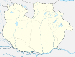
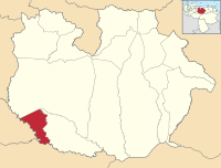
Coordinates: 8 ° 7 ′ N , 67 ° 36 ′ W Camaguán on the map of Guárico
|
||
| Basic data | ||
| Country | Venezuela | |
| State | Guárico | |
| Municipio | Camaguan | |
| City foundation | September 24, 1768 | |
| Residents | 18,000 | |
| Detailed data | ||
| Post Code | 2313 | |
| prefix | (+58) 247 | |
| Time zone | UTC -4: 30 | |
| City Presidency | José Vásquez ( PSUV ) | |
Camaguán is a city in the southwest of the Venezuelan state of Guárico and the headquarters of the district of the same name . The city has about 18,000 inhabitants.
history
Camaguán was founded on September 24, 1768 by Father Tomás de Castro on a hill on the left bank of the Portuguesa River. The actual village only grew years later. In the beginning it was a monk-administered settlement in which Guamo Indians lived.
In 1872 Camaguán was declared the administrative seat of the Departamento Crespo.
economy
The region's economy is predominantly agricultural. Mainly rice, corn and beans are grown.
geography
The city lies on the banks of the Portuguesa River.
Nature reserve
There is a nature reserve in the region, Esteros de Camaguán, with a total area of 19,500 hectares.
traffic
Camaguán is connected by a road (N2) with Calabozo in the north and with San Fernando de Apure in the south.
politics
The Camaguán District has its administrative headquarters in Camaguán City itself. The Mayor, José Manuel Vásquez, belongs to the PSUV .
In the 2010 elections for the National Assembly, 66.11% of the people voted for the PSUV list candidate , while 18.30% voted for that of the AD party and 14.24% for the PPT .

