Delta Amacuro
| Delta Amacuro | ||
|---|---|---|
| Symbols | ||
|
||
| Basic data | ||
| Country | Venezuela | |
| Capital | Tucupita | |
| surface | 40,200 km² | |
| Residents | 197,200 (2017) | |
| density | 4.9 inhabitants per km² | |
| ISO 3166-2 | VE-Y | |
| politics | ||
| governor | Lizeta Hernández | |
| Political party | United Socialist Party of Venezuela | |
Coordinates: 8 ° 52 ′ N , 61 ° 31 ′ W
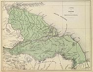
Delta Amacuro is a state in Venezuela ; it is located in the northeast of the country. Its capital is Tucupita . Here the Orinoco flows into the Atlantic. The island of Trinidad lies off its coast . The average temperature is 26.7 ° C. The amount of precipitation is between 900 and 2,500 mm per year. The state governor has been Lizeta Hernández (PSUV) since 2008. Their term of office is four years.
population
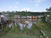
The Warao are the traditional inhabitants of this region. They have their own language, Warao . For decades, more and more immigrants, especially criollos who work in the oil sector or in tourism and fishing, as well as immigrants from Guyana have settled in the Delta Amacuro. In Tucupita and Pedernales mainly non-Waraos now live.
history
The Warao lived in this region long before the Europeans arrived. Due to their inaccessible location, they were able to live relatively independently for a long time.
On October 1st, 1498, Christopher Columbus reached the coast of the Orinoco Delta during his third voyage to America. Soon the region became the gateway to Guiana. Diego de Ordaz explored the area in June 1531 when he started his expedition through the Orinoco with several ships. Antonio Berrío traveled here in the eighties of the sixteenth century. Fernando de Berrío , the son of Antonio Berríos, also traveled through this region on his search for El Dorado. Walter Raleigh sailed here in 1594, 1595 and finally 1616.

The delta was part of the province of New Andalusia in the eighteenth and early nineteenth centuries . Alexander von Humboldt wrote that at the end of the eighteenth century the Waraos were the only original Americans who were completely free in New Andalusia. He said that in Venezuela it is assumed that around 6,000 to 7,000 waraos lived on the delta. In his estimation, however, the number was lower.
When Venezuela gained independence, the area became part of the Province of Guiana.
The Catholic priest Baral began setting up missions and schools in the area in the 1930s. He also studied the Warao language and wrote the first dictionary of this language.
economy
Delta Amacuro is one of the poorest regions in Venezuela. The main sources of income are fishing, livestock and the oil industry.
Administrative division
The state is made up of four districts ( Municipios ), which are further subdivided into 22 Parroquias :
|
|
Attractions
Natural sights
- Caño Araguaimujo.
- Caño Macareo.
- Caño Manamo.
- Guasina and Sacupana islands.
- Orinoco-Mariusa Delta National Park .
- Toro and Acoima waterfalls.
Other sights
- Fortress of San Francisco de Asís.
- Guiana locks.
- Warao settlements.
Individual evidence
- ↑ Urs Bitterli: The discovery of America (1999). P. 282
- ↑ Journey to the equinoxes of the New Continent. Edited by Ottmar Ette. 2 volumes. Insel, Frankfurt am Main and Leipzig 1991, ISBN 3-458-16947-4


